|
|
|
|
3rd April 2020 CDU Newsletter 645
Some people who have been getting this newsletter for years have said they no longer get it. I'm not sure why they don't get it now or who has dropped off the list but if you know someone that doesn't receive it anymore please tell to enroll again on my website. https://canoeingdownunder.wordpress.com/
It's not the best website but since being hacked I don't really want to spend thousands to make it better.
*****************************************
There is debate in Victoria at the moment -
Boating has been banned so paddlers have been told they can't paddle.
Will it come to WA?
Should paddling be classed as boating?
Recreational activities such as golf, fishing, boating and camping are banned in Victoria in the latest crackdown against the coronavirus crisis.
'Basic exercise' has been declared as the only outdoor activity exempt from the statewide outdoor ban.
It comes as the state recorded its sixth fatality from the virus, taking the national death toll to 24.
Victoria was the first state to enforce a stage three lockdown on Monday, where people are urged to stay at home except for food and supplies, medical care and caregiving, exercise, and work or education.
Restrictions on gatherings of more than two people are also banned.
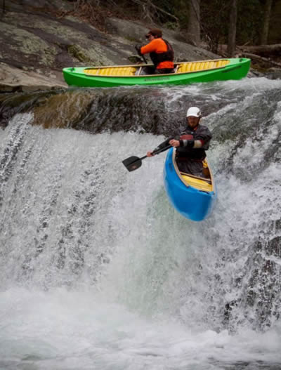
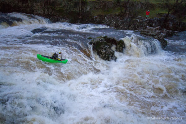
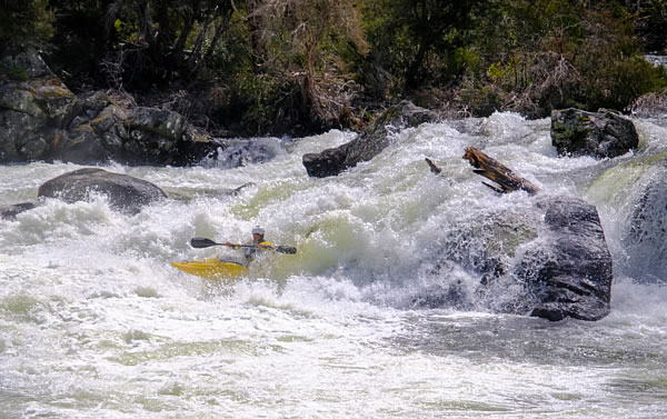
Snowy River Extreme Race
The Snowy River Extreme Race is a whitewater event held on the iconic Snowy River in Kosciuszko National Park. The Event takes place on the October long weekend and consists of two races; an Expert race, and an Intermediate race. Both races take place on the stretch of whitewater between Munyang power station and Island Bend campground.
Like most sporting events this race is unlikely to go ahead this year.
C1 paddlers getting ready for the Snowy River Extreme Race. Silverbirch Canoes.
C1 paddlers getting ready for the Snowy River Extreme Race. - Silverbirch Canoes.
The Snowy River Extreme Race 2019. Photo Michael Taylor.
Snowy River Extreme Race 2019. Photo Michael Taylor.
Snowy River Extreme Race 2019. Photo Michael Taylor.
A Rescue Mission
I was in self-isolating (apart from paddling and going to the supermarket once a week) but then on Saturday afternoon I got a SOS call from friends, who were walking the full length of the Bibbulmun Track, asking me if I would pick them up from near Walpole because the huts on the track and shops etc in towns were now closed and the road up to Perth was being
closed on Tuesday. A ranger had told them they had to go back to Perth, and with the buses not running I was their lifeline.
So Saturday afternoon I prepared my landcruiser for a 925 km round trip to Denmark/Walpole and left Sunday morning at 6.20am. The roads were quite busy up to Armadale but once on the Albany Highway there were more dead and alive roos on the road than cars. Each service station I passed was deserted and it wasn’t until Williams before I met a few caravans and a
few locals on the road. It was quite strange heading down south with things so different, a virus epidemic and knowing that after Tuesday there was a lock-down and no-one could drive up to Perth from Albany or visa-versa unless for a very good reason.
My idea was to reduce contact with people and places as much as I could so I packed lots of food and drink, had a full tank and a reserve tank of fuel, put in an extra spare wheel, giving me two and made sure I had lots of tools, tyre pump, battery leads, tow lines and lots of water and soap. What I didn’t know was how healthy my two friends were and had they
been mixing with other people who might have the virus. Although they had been on the track for ten days they had been to the Peaceful Bay Caravan Park.
I passed the deserted community of Arthur River which reminded me of the time I paddled down the Arthur River and onto the Blackwood River going all the way to Augusta taking 8 days. There were 3-4 cars around the café at Kojonup but it too was quite dead. I worked in Kojonup in the winter of 1974 on a sheep farm and it was cold, real cold after coming down from
working in the Kimberley. I remember going to the Katanning drive-in and my god wasn’t it cold that night and I didn’t have any one to snuggle up to.
The busiest part of my journey was from Mount Barker to Denmark. It was also the worst part of road, narrower and uneven and to make matters worse I lost the ABC radio signal. I had been listening to Australia All Over since leaving, and Australians around the world were talking a lot about the Corona Virus, so it kept me occupied. I then pressed the scan
button to get another radio station and the first one that connected was a Christian channel which I don’t mind if the music was right but the presenter started preaching which didn’t quite sit well with me so I scanned again and got Triple J. With many of the songs using a lot of swear words, that didn’t sit well with me either. I still have a thing about swearing that I can’t really get used to. I can’t understand why our general language has to contain so many swear words when we have so
many other descriptive words to choose from. Is it that I’m just too old and out of touch with todays world! I pressed the scan button again and this time I got radio Albany which wasn’t perfect, but it was better.
I only have a tape deck / radio in my landcruiser, so I couldn’t put a CD on or a stick to play my favourite music and I had no tapes, so it was the radio or nothing. I always remember paddler Paddy telling me I had bought the ‘poverty pack’ landcruiser with no frills.
At Denmark I stopped my vehicle to get fuel for the first time. Up until then I had been stopping at lay-byes to have a pee, a cup of coffee and a nibble of food. I had to take as many precautions as I could so I didn’t get stranded down there, so I didn’t stop the vehicle until I got to the fuel station.
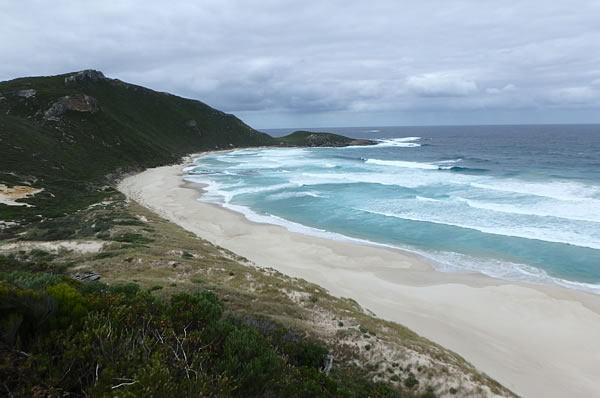
My speed was reduced on the way from Denmark to Conspicuous Beach Road by a van that thought 70kms was the top speed it could go. After the turn-off it was 6.5 kms to Conspicuous Beach and where my friends Peter and Megan were. It was a beautiful place. They had been on the track for 10 days so they had a lot to catch up on so I was doing a lot of talking on the
way back which was unusual for me!
Conspicuous Beach looking west.
Conspicuous Beach looking east.
They were a little disappointed to leave to track as they were attempting End to End and were looking forward to the forests, but they were also overjoyed I had arrived and they could get back home.
Heading back there was hardly a sole on the roads until we got to Manjimup. We picked up two food parcels that Peter and Megan had sent to local tourist offices along the way and we arrived back home just after 6.00pm without an incident and without getting stuck on the freeway.
Now it’s back to self isolation.
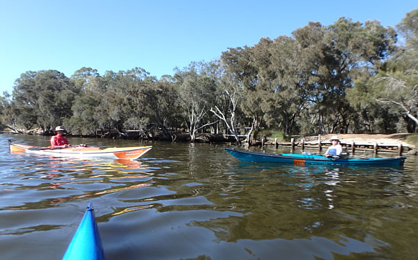
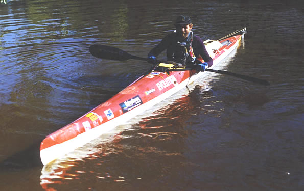
It was good to see Kevin Piper and Ken Burton on the river this morning. I often see Kevin but its been 8 years since I saw Ken. The last time I saw him, he bought the Mirage kayak from me that he was paddling. We had a good old chat.
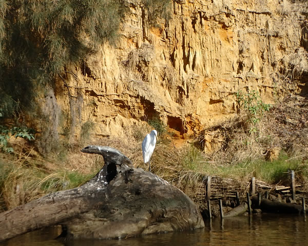
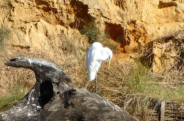
This Egret that I saw this morning below Success Hill looked a little depressed. It probably knows what is going on in the world. If paddlers are confined totally to our homes we might be holding our heads low.
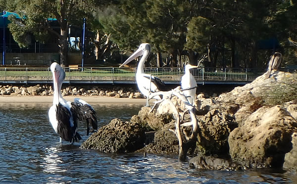
Social distancing.
On Ron Courtney Island opposite the deserted Ascot Kayak Club.
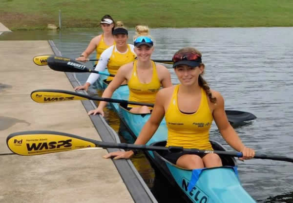
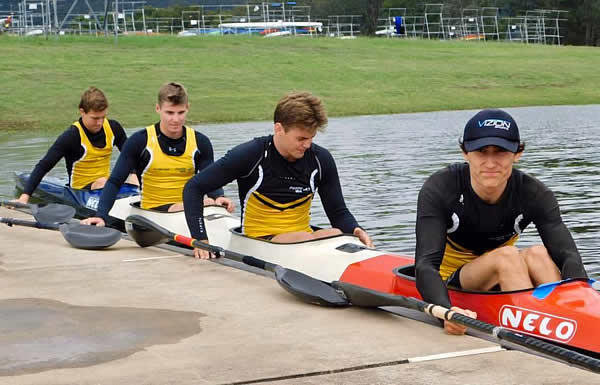
Australian Sprint Championships
The K4 junior ladies at the Australian Sprint Championships.
The K4 junior men at the Australian Sprint Championships.
AUS U23 & Junior Sprint Teams Announced
Congratulations to the following WA athletes selected to the Australian U23, Junior and Olympic Hopes sprint teams!
U23 Team
Yale Steinepreis (BPC)
Junior Team
Harriette Alexis (BPC)
Luke Egger (CRCC)
Olympic Hopes Team
Harriet Brown (BPC)
Jeremy Alderson (BPC)
Tim Hyde (CRCC)
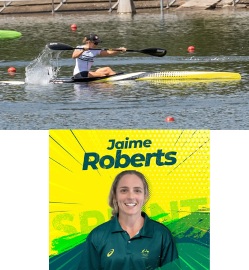
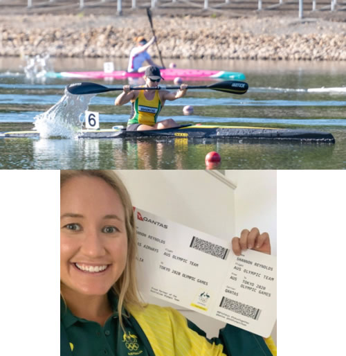
Australian Olympic Team Selection
Two of WA's current top sprint athletes have just been selected for the 2020 Australian Olympic Team for Canoe Sprint! Huge congratulations go to:
Jaime Roberts (WAIS)
Shannon Reynolds (WAIS)
Their selection comes after the unfortunate postponement of the Tokyo 2020 Olympic Games which has now been rescheduled for 2021. Nevertheless, being selected to the Australian Olympic Team is
a dream that many people have, but very few can achieve. Jaime and Shannon's selection is a credit to the hard training and racing they've endured for over a decade, and we have absolutely no doubts that they will both do our sport, WA and Australia proud at Tokyo 2021!
Paddle WA and the WA Sprint Technical Committee would like to wish Jaime and Shannon all the best as they continue to train in these very challenging times. We hope to see them come out just as fast when this is all over!
Paddle WA
Who's Going To Tokyo
Paracanoeists
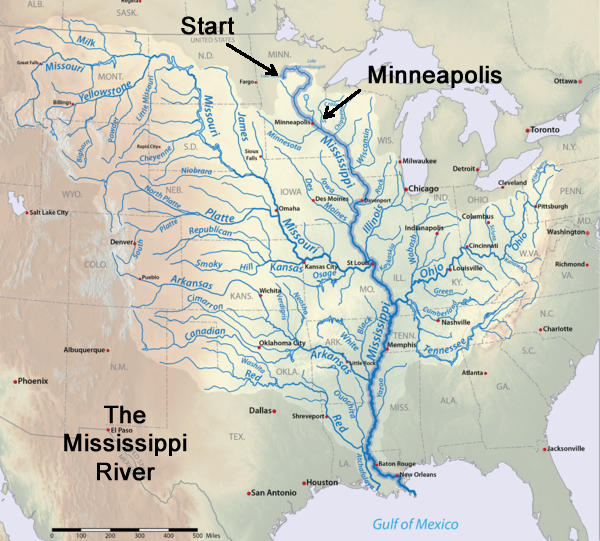
The Mississippi River Expedition continued
part 3
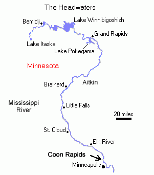
The Mississippi River & connecting rivers.
Saturday 27th June 98 Grand Rapids
I only got 5 hours sleep as I was up by 6.30am enjoying pancakes, melon, orange juice and coffee that Mary had cooked and prepared. We had a good chat over breakfast about mines, casinos, summer holidays, how houses are made, autism, parks and the fact that the town was the childhood home for Judy
Garland and that Julius had been a school teacher so it was 9.15am by the time I got moving. We put all my gear in their car and I carried the kayak 160 metres to a put in point below the Blandin Paper Company Dam and then they left me to pack the kayak. The town of Grand Rapids was named because of the 5 kilometres of rapids on the Mississippi which stopped all steamboats motoring upstream, but they are now buried because of the dam.
By 10.30am I was away. It was a late start but the relaxed time with Mary and Julius was well worth it. As I headed downstream I saw my first herd of cows and it was quite exciting. The riverbanks were forested with fields intermingling and high banks with trees falling from them due to erosion.
Some of the trees were dangling as half the soil underneath had slid leaving roots to hang precariously and exposed.
Not far out of Grand Rapids the Prairie River entered which was supposed to have doubled the water flow which I hoped meant a faster current. An eagle hovered above as a deer stood on the riverbank watching me get closer. It darted before I got too close. A little later I spotted a huge turtle on a log
and it allowed me to get really close before slipping into the water.
The river was twisting and turning which was enough to make me dizzy. The current wasn’t moving terribly quick, nevertheless I was feeling good and making close to 10kms an hour. After passing through the town of Jacobson I met 3 guys and 2 kids in a boat anchored near their house. I stopped to talk as
they sipped beer but they didn’t offer me one which was quite disappointing. At the beginning of the trip I decided that if anyone offered me something I would take it.
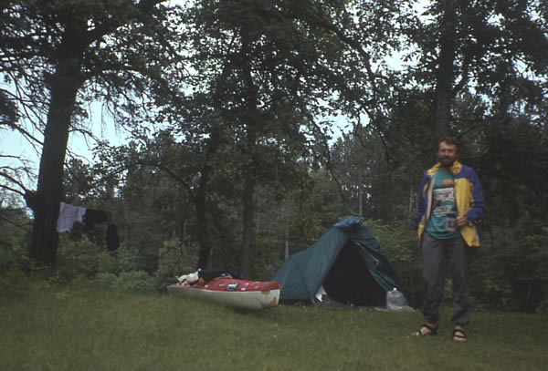
The light was fading so I moved on and managed to reach the Keto primitive campsite just before dark at 8.45pm. I had paddled 94 kilometres.
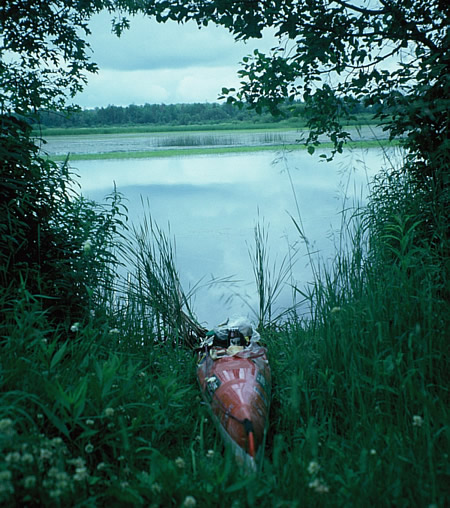
A primitive isolated camp spot away from the road and people.
Sunday 28th June
There was thunder, lightning and really heavy rain in the night. I moved off with forest on each side of the river with a few farms and houses dotted along the way to Pallisade. I stopped at Lee Ferry Access to change back into my booties having tried paddling in my sandals but they were too bulky and
I couldn’t straighten my legs when I wanted. Passing the Sandy Lake River, where there was a dam and a lake upstream a deer was at the water’s edge. It didn’t see me but by the time I took my camera out I had floated by it. Like a statue its ears were twitching as if it knew something was around but couldn’t see it. I floated on watching.
By the time I reached Palisade at 3.00pm I had passed several eagles and the odd beaver. I walked to the shop and bought bananas, cheese, bread, a coke, pop-tarts, cereal, tin potatoes, 2 apples and an ice lolly. I had done my shopping in my paddling gear and after I came back I realised what a
sight I looked. Back at the park an old guy on his 4 wheeled scooter came to admire my kayak. He said he hadn’t seen one like mine before. He picked up the bow twice which crunched the rudder but didn’t damage it. He also said there were no mosquitoes in town, just the one that was biting me. I ate lunch and pushed on towards Aitkin at 4.20pm.
I was paddling sluggishly after having such a big lunch and the strong wind didn’t help me to feel any better. It wasn’t a good feeling. Loads of swallows were in flight and nesting under bridges that spanned the river. I came to a Low Head Dam and diversion channel and if I took the diversion route it
would have only been 10kms to meet up with the river but following the river towards the city of Aitkin as I did, it was 39kms.
The land around Aitkin County is pretty flat and the river winds all over often at times taking 2 to 3 miles of river length to move across on mile of terrain. The Americans work in miles so I had to do a lot of converting although later on I got used to miles.
The low banks of the river made this area very prone to flooding. After an especially severe flood in 1950 the US Army Corps of Engineers designed a diversion channel to carry flood waters past the populated areas of Aitkin City.
The river makes a large U shape, with the city of Aitkin at the bottom of the U. The diversion channel is 6-1/4 miles long, but cuts off 24 miles of river. It works because water always wants to flow down a steeper path. The shorter the path, the steeper it will be.
To prevent all the Mississippi River water from flowing down the steeper diversion channel, a low head dam was installed at the entrance of the channel. During low and normal river levels all the water flows down the river channel past Aitkin. Once the water rises to the level of the dam it starts to
flow over the low head dam and into the diversion channel and prevents flooding around Aitkin saving millions of dollars in flood related damages.
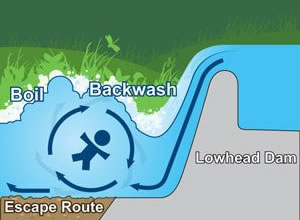
Low Head Dams can be very dangerous. The water flowing over a drop forms a hole or hydraulic at the base which can trap objects and paddlers washing over the drop. A recirculating current is formed below the dam so once swept over the dam a paddler can
become trapped and is forced underwater, pushed away from the dam, then circulated to the top. The circulating motion then repeats the cycle over and over again as the person is drawn back against the base of the dam. These dams are usually loaded with logs and debris which circulate closer to the surface and rocks and steel bars just below, posing additional problems. It’s best not to go over one.
I moved along with the sun going down and I eventually arrived at the Aitkin campground with little light at 9.40pm having completed 106 kms. It was the first commercial campground I stopped at.
Monday 29th June 98
I was up at 6.20am and as I was packing a guy, Fred Schweizer from California came over to talk to me. A little later as I was about to leave he came back with his wife, Barbara. They took my photo and told me to call into their home in Redding if I was passing their
way.
The current was much slower since the diversion route had taken some of the water so I was doing about 9kms an hour. There were several farms along the way most with Dutch Barns many in ruin. I eventually joined up with the diversion channel after 39kms and instantly the current quickened which gave me
a little joy. It wasn’t long before I saw a deer an eagle and nest on a top of a telegraph pole. There was another eagle on a pole further along. One nest had chicks inside. After about 35 kilometres I stopped for lunch at Lone Pine Campsite where I sat on a seat eating cheese sandwiches and pop tarts. The site could only be reached by river so there was no one there.
About 17 kilometres later the river headed south and for the first time since starting the river it straightened, became wider and headed in the right direction. The banks were laden with grasses and trees surrounded by scenic hills. A heavy rain squall descended on me but it passed after 15 minutes.
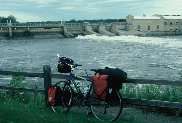
I arrived at Portlatch Dam with a 300 metre portage which didn’t take too long to walk. There were lots of mossies hanging onto me on the walk and a lot of water going over the dam wall. I soon started paddling through the town of Brainerd, under bridges with the current running fairly fast. Posh
houses lined the river which would make anyone feel envious. There are 460 lakes within 40 kms of Brainerd, most were to the north of the town.
I arrived at the Baxter canoe primitive campsite just before 9.00pm paddling 100 kms for the day. It rained slightly but not for long which made the mozzies come out to play. They were so bad I washed inside the tent. It was hard to sleep as there were funny animal noises, mice running and nibbling,
moths flapping, a frog that climbed inside the tent inner, another one that was jumping on my kayak and a beaver or something slapping the water. No wonder they call the campsites primitive.
A quick break in mosquito country.
Tuesday 30th June.
So when I awoke at 6.00am I was extremely tired so I could imagine I would be nodding off in the kayak today. I made a great effort not to go back to sleep. It had been like I had slept inside a zoo. Deer prints were around my camp, a deer was grazing a distance away so I imagined the hissing/snorting
I heard in the night must have been from a deer. There must have also been something quite big as my rubbish bag was well ripped apart.
I tried to get going quickly forgoing my usual coffee but it was still 8.15am by the time I paddled away. Within 5kms I was in the Crow Wing State Park watching a deer on the shore that didn’t know I was floating by. There wasn’t much happening in the park or at the Military Training Area and Nature
Reserve further along apart from several deer wandering the banks and eagles in the trees.
Reaching Little Falls I pulled out just before the dam, put my trousers over my canoeing gear to look respectable and trotted off to the post office which was only 100 metres or so away, to send some postcards.
I found a telephone to ring Jean, a lady I met when I was cycling to Lake Itasca who was holding a food parcel for me in Minneapolis. There was no answer so I walked to the bakery and bought a big sticky bun filled with apple. What a treat. On the way back to the kayak I called in at the outfitters and
filled my water bottles.
It was a 325 yard portage and a bit of a struggle. At the put-in point a big eddy sheltered me from the swift current flowing over the dam but once moving I had to paddle against the current and then turn with the flow. I was a bit shaky but once across the current I stopped on the other side to get a
photo. The water going over the dam was much more powerful when I passed this way on my bike.
The put in point below Little Falls Dam.
I started singing to keep awake and a bunch of school kids on a jetty heard me. They asked if I was happy and several other questions as the current whisk me away. Their voices soon faded and I was alone again.
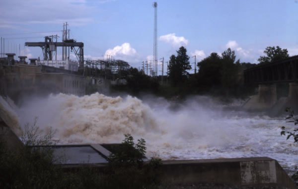
The river was now much wider than the last few days and I soon arrived at Blanchard Dam where I had to portage on the right. There was a mighty huge stopper directly below the dam and swift current below it. It looked a spectacle.
A huge amount of water creating an awesome spectacle.
Blanchard Dam.
The trail was not good on the downstream side of the dam and because of the water height it was hard to find a suitable put in point. The track down to the river was slippery with bushes and trees that were close together so I kept getting the nose of my kayak stuck in a bushes and the wrong side of
the trees. It was a ‘not happy Jan’ moment. At the bottom of the slope, next to the river I came across a women sitting on the ground collecting rocks with crosses on. We had a few words before I laboured on.
I found a slightly better track on the way back but neither track were good portage tracks and one hell of a struggle carrying the gear down. After my third trip I had everything at the kayak. I loaded the kayak with turtles that were lazing on the rocks watching on. The current was pretty powerful and
waves and turbulence were buffeting the shore so it wasn’t easy to launch, especially having a long kayak that was impossible to get the cockpit close to shore because of all the bushes. It meant I had to wade out into the river and step into the kayak knee deep. With the waves hitting the kayak broadside it was impossible to put my spraydeck on so I paddled out into the current hoping I wouldn’t get swamped. Just as I was about to turn and head downstream in the turbulence, the rudder cable
came apart. Now I had no steering but I managed to keep upright and paddled downstream to find a sheltered spot to stop and fix the problem.
I had wasted a lot of time but some fast water below the dam helped me along. I came to a private campsite so I walked up to the office and made a phone call to Jenny, which took 3 goes and a call to Jean in Minneapolis, but no answer.
My long kayak made putting in the water a tricky job.
Waves lapping the shore didn't help.
I continued my journey and passed Stearns County Park where there was free canoe camping but I kept going seeing more deer including 2 fawns and their mum and later on I started seeing deer with antlers.
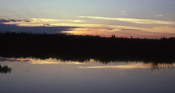
A boat stopped to chat and the people gave me a can of mountain dew which was appreciated. Nightfall brought on a beautiful red sunset and as it got dark it was a pleasant paddle passing the lights of houses as I paddled towards the town of Sartell. I arrived at the Sartell boat ramp in the dark at
9.50pm having paddled 105 kms. There was no one around so I camped.
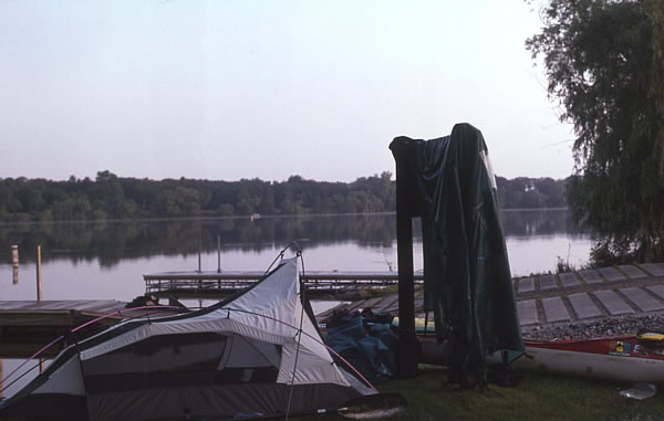
Camp at Sartell boat ramp. Drying the fly sheet.
Wednesday 1st July
I had a good nights sleep at the side of the boat ramp and there were no hooligans to annoy me so that was good. The tent was soaked because of the heavy dew so I tried drying it before I took off. I had a quick breakfast of cornflakes as I watched the sun come up bringing a beautiful morning. I was
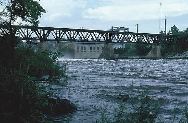
off by 7.30am but within 2.5 kms I had to portage a dam at Sartell where there was a large paper mill close by.
The Sartell Dam marks a special location on the Mississippi River where it passes through the 1000 foot in elevation. From Lake Itasca, the river has fallen 347 feet in 415 miles. This is a fall of about one foot per mile of river. As we are only 121 air miles from Lake Itasca, which represents a fall
of 3 feet per mile of actual progress towards the Gulf of Mexico. From this point heading south, the river has 1900 miles to fall the remaining 1000 feet, a fall of one foot every two miles.
It was a long walk around the dam to a safe place to get in because of the high turbulent water. At least the track down to the river wasn’t as bad as the last dam.
A picture of Sartell Dam when I rode past it on my bike.
I paddled down towards Sauk Rapids and stopped before the bridge to take the foam pad off my seat to lower my centre of gravity. On my cycle up to Lake Itasca I had checked out the rapids but the water was lower then and not as rough. I thought about walking to check them out but it was too difficult
and time consuming and I didn’t want to leave my kayak so I decided to run the rapids blind.
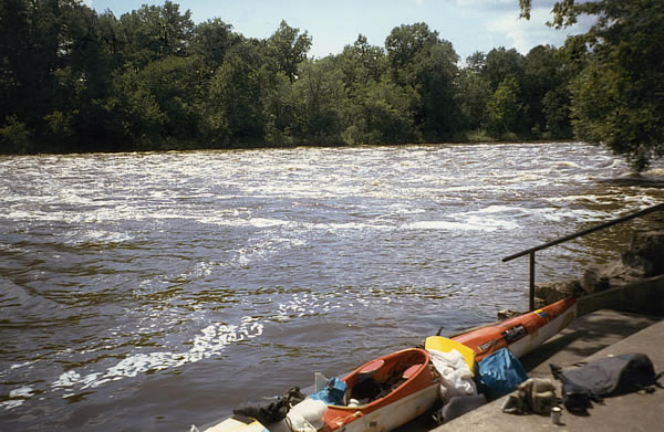
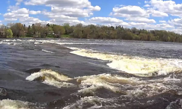
The current quickened and now there was no turning back. My 6 metre kayak was too long and too heavy to do any fancy turns so I had to commit and go. I dodged many of the waves and small drops under the bridge but the rapids below the bridge looked bigger. I slid from under the bridge and hit some
turbulence an un-regular, clapping waves. I looked ahead for gaps in the rapids which veered over to the centre and left side, and although I missed most of the bigger waves I edged over lots of turbulence and confused wave action.
Because of my large cockpit I couldn’t brace my knees like in a wild water kayak, so it was much harder to balance, nevertheless I made it through the 600 metres of white water. Luckily there weren’t any really large drops and I could thread myself around most of the bigger drops that were
there.
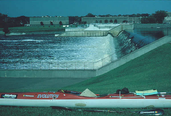
Once free of the rapids I could relax again and paddle through the small city of St Cloud to the next dam 4.5 kms away watching ducks with their young along the way. The St Cloud dam had a short and easy portage which pleased me, but it was quite rough and turbulent at the bottom where I put in, so I
wasn’t able to put my spraydeck on, until later when I found a quiet eddy.
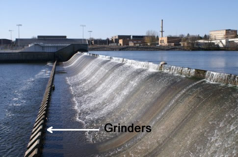
The dam had two interesting features. First it featured lift up gates that can control the water level up to 3 feet. Second the dam has grinders (also called dragon teeth) at the bottom of the falls to grind up debris and calm down the water. These grinders are a series of tooth-shaped concrete blocks
that stick up about a foot and half from the river bed. The water is also calmer downstream of them. It was impossible to see the grinders because the water was so high.
The end section of Sauk Rapids.
The grinders at the bottom of a weir.
The river split into several channels further down creating lots of islands, it then formed one channel for 20kms with about 6-8 islands down to the town of Clearwater where I had my haircut on the way up. I wasn’t expecting to see any more deer but I did.
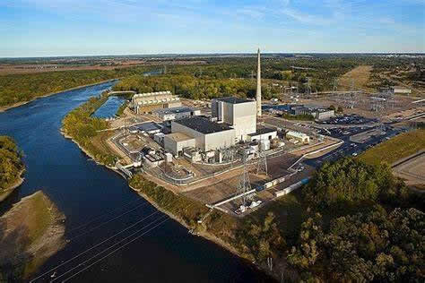
I later passed the Monticello Nuclear Generating Plant and although it was impressive I didn’t dilly-dally. Further along was the Montissippi County Park where I had camped on the way up and saw about 50 turtles on a rock, many jumped off when I got too close.
Monticello Nuclear Generating Plant.
I came ashore near a bridge where there were some lads in a park, left my kayak and walked to a service station to find a phone. I walked in my stripy thermal long johns and paddling gear and I could see people looking at me and I’m sure they were laughing at me under their
breath.
The phone didn’t work but the management allowed me to use their office phone to ring Jean. I was getting closer to Minneapolis so I needed to know that she would be there to hand my food over. I bought a coke and a pop tart and they gave me a couple of donuts because they were being thrown out. By the
time I returned to the kayak which was still there and not been robbed I had been away 90 minutes.
The current was pretty quick when I got back in and I soon got to Elk River 20 kms away where motorists were continually blowing their horns on the highway for some reason not known to me. It was a swift trip through Dayton and Anoka but I had to keep singing to keep awake. I stopped at a park near Rum
River where two lads were fishing and they said they had never heard an accent like mine before and just wanted me to keep talking.
There were many houses along the river, many very flash and very huge with float planes parked up. Skiers and jet skis were speeding up and down. Although I love to be in the wilderness it was good to see life in a town.
I arrived at Coon Rapids Dam where I had to portage. A telephone there gave me the opportunity to ring Elaine in New Jersey, to tell her how I was getting on, ring Bill who I had met earlier on the Appalachian Trail and lives on the Mississippi and Gary who I also met on the Appalachian Trail and who
also lives on the Mississippi. They both told me they would put me up for the night. I also left a message Jean again.
The park was very busy with walkers, biker’s people on roller blades and people fishing. A fisherman started talking to me and then gave me a hand getting my kayak down to the river’s edge.
The Coon Rapids dam doesn’t have a lock system for navigation like all the other dams upstream which were installed for a variety of reasons from flood control, reservoir management, hydro power and logging. That means that this dam is the true head of navigation as all the dams down stream of this
point have locks making the river downstream navigable. The Coon Rapids dam is primary for recreation and to maintain a constant pool depth, perfect for boaties and water skiers like I had seen earlier.
I was now entering a built up area with houses and factories lining the river which always brought me concern especially if I had to find somewhere to camp. I was hoping 2 islands 1.5 – 2 kms downstream would give me safety if I could find somewhere to camp on them. I managed to land on the second
island only about 250 metres from a bridge that crossed the river. It was getting late so I wasn’t expecting any riff-raff to swim across the river to annoy me, so I felt pretty safe. There was a bit of sand on landing, just enough cleared space to erect my tent and plenty of duck shit which I had to put up with. I was in bed by 12.20am having completed 110 kms.
Tomorrow I paddle through the big city of Minneapolis and St Paul.
|
|
|
|
|
|
|
|
|
|