|
|
|
|
15th February 2019 CDU Newsletter 606
|
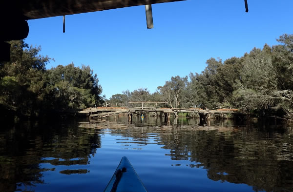
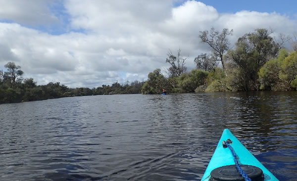
We see some great things from our balcony, paddlers going by, rowing coaches shouting at their rowers, speeding powerboats, the ice cream boat, birds, pelicans, dolphins, cormorants in their hundreds, walkers, cyclists, horse riders, planes, you name it we see it but yesterday I watched a fisherman carry a one metre shark that he had just caught to his car, put it in the back and drove away, I suppose taking it home to fillet it. It is the second small shark that I have seen
caught in the area in the last three weeks.
Don't fear though. The good news is there have only been 5 recorded shark attacks on the Swan River and only one fatal attack in 1923 at Freshwater Bay, Claremont, 5 miles from river mouth. The latest non-fatal attack was in 1973. The closest non-fatal attack to Bassendean was in 1969, 13 miles upstream of the river mouth although the record doesn't name the location. But going by the milage it would have either been in the South Perth area or around Mount Henry Bridge area.
Although there was a report of one attack being near Garrett Road Bridge many, many years ago.
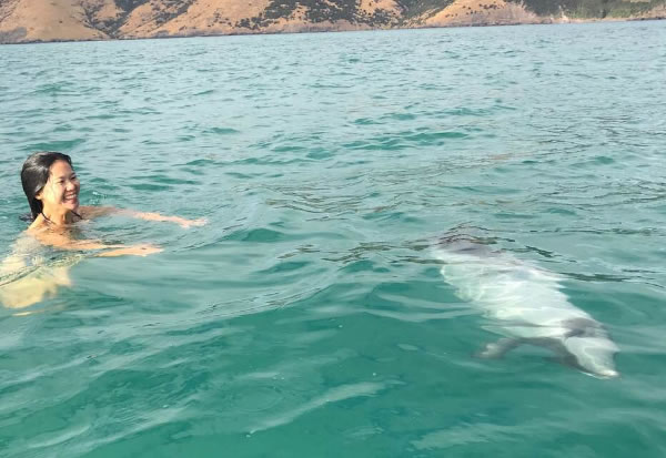
Jason Gardner is holidaying back in his birth place New Zealand with Fifi.
Jason paddles a SUP while Fifi swims with dolphins on the Akaroa Harbour.
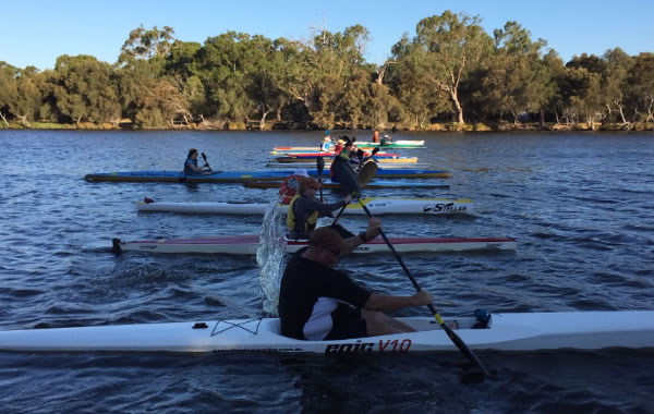
A few of the Progressive Racing Group are going to take part in the Saturday Morning 4km race. If you haven't raced before and want to give it a go why not come down to Sandy Beach and join the PRG group and the regulars.
Be at Sandy Beach at 7.15am for a 7.30am start.
The Progressive Racing Group on a Tuesday evening.
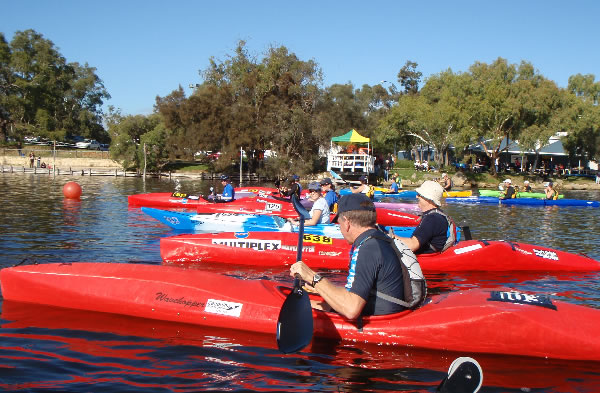
Buoys Race
The Summer Season Down River Around the Buoys training on a Friday Morning has now finished.
However we are having a Friday evening race at Ascot kayak Club next week the 22nd February.
Buoys Race. Ascot Kayak Club
5.15pm - Practise and 2 runs.
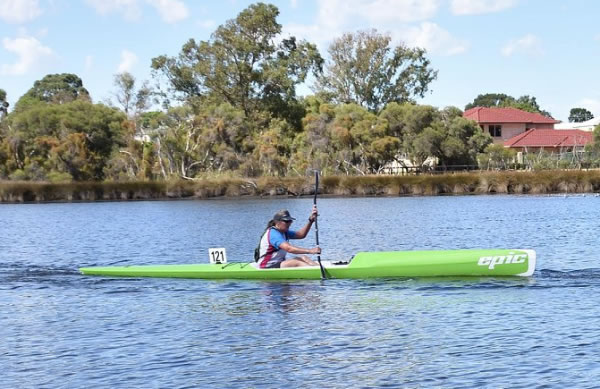
This was when racing a plastic kayak was popular.
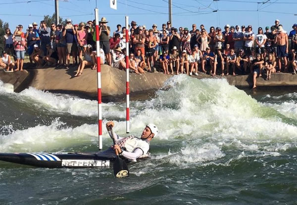
Coach Robbie Jeffery back in a canoe at Penrith
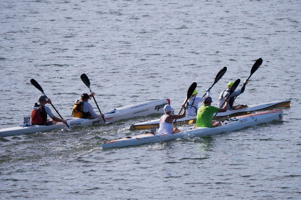
Kieran Simpson and Christopher Greed are there racing in the Wild Water Event and hoping to be selected for the Australian Wild Water Team.
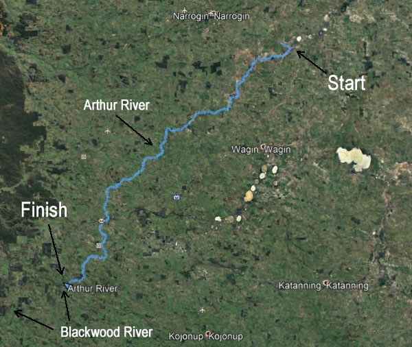
I don't know about you but every time I see someone head out on an expedition that includes a kayak and camping gear I get so envious. Last year a group of AKC paddlers paddled the Arthur River from the source to the start of the Blackwood River.Their log written by Richard Molek is below.
Arthur River Descent
August 2018
Team: Richard Swindale, Alan Morbey, Steve Coffee and Richard Molek.
The source of the Arthur River is disputed by those who live near it. Some say the Arthur River Nature Reserve, a beautiful expanse of wetland near the confluence of the Yilliminning River approximately 20kms south east of Narrogin. Others
say 20kms further inland as far north as Toolbin Lake. Whatever the true source, an idea grew in the mind of paddler Richard M that this river should be paddled from beginning to end, so once again fellow paddlers Alan, Steve and Richard S were persuaded to abandon their normal routines and launch four kayaks into a fairly obscure and unknown river.
As with previous expeditions down the Blackwood, Hotham and Pallinup Rivers, information on conditions and hazards was in short supply. Would there be water flowing for the full 180 odd kms to the Arthur’s junction with the Blackwood? Would our equipment survive eight days in the
water, being dragged through mud, battered against trees, scraped over fences? Would the bodies encasing four aging retired and semi-retired paddlers remain intact?
An earlier reconnaissance made it clear that flowing water with sufficient flow to support a 15kg plastic kayak, along with a censored kg paddler, would appear approximately 10kms north of the Reserve – so that’s where we started our expedition. Success would need a
little planning, a little perseverance, and a lot of luck. Water levels too low would turn the upper reaches from a pleasant paddle into a boat-dragging torment. If too high, every benign thicket of trees or farmer’s fence would become a mentally draining maze of deadly strainers. In fact the Arthur gave us a bit of everything.
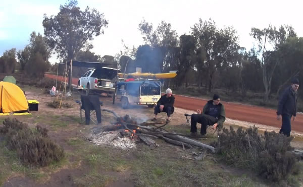
The shortcomings in our meticulous preparation became evident within an hour of putting in. The overall plan was simple. Each day we would have three paddlers on the water and one support person (on a rotating shift) in a 4-wheel drive with all the gear. The support job was to
get the paddlers to the put-in location, then meet the paddlers at pre-planned waypoints – each carefully calculated and based on a conservative estimate of average paddling speed over a particular section of the river. After the penultimate waypoint, the support person would then scout a pleasant camp site and set the fire in anticipation of tired but happy paddlers rounding the final bend shortly thereafter.
This strategy allowed the paddlers to carry a minimal amount of equipment on the water, and therefore less weight and a higher draft in low water, but also relied on paddlers and support meeting at specific way points on the river to re-supply and camp. What could possibly go
wrong?
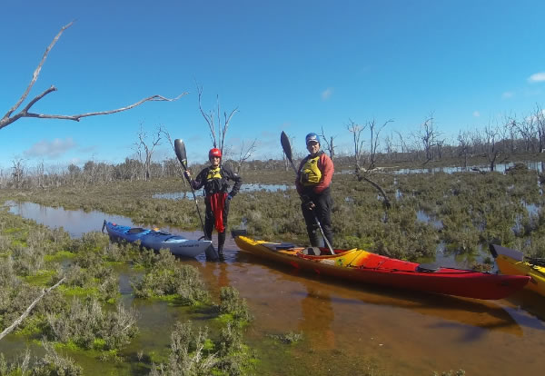
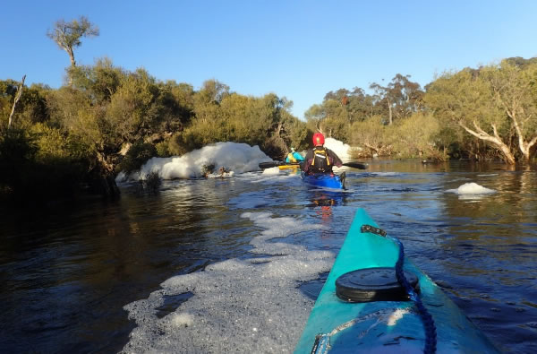
Quite a bit, as it turned out. On Day 1, after an hour of paddling along a narrow but well-defined stream, our river opened into a vast wetland maze of multiple channels, dead-ends and wrong directions. The agreeable paddling turned into a mixture of lengthy boat-dragging,
head-scratching and mosquito-swatting ordeal.
Where did all the water go?
It seems that the Yilliminning River wanted to turn into the Arthur, but become lost along the way, along with us. No channel was paddleable. After walking 3 kms in water barely lapping at the ankles, some of the channels finally came together, and walking
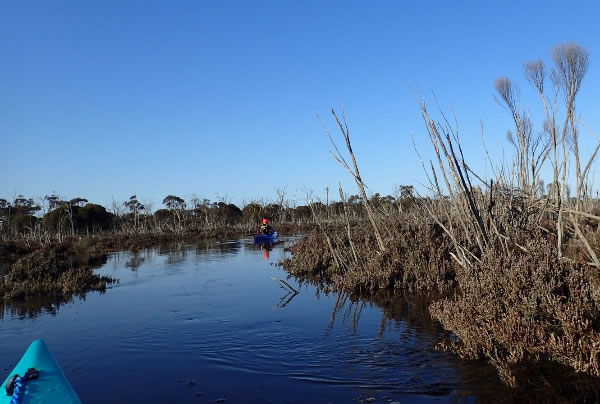
occasionally turned to paddling. Finally the river opened into an eerie, grave-like wetland, and we were in the boats more often than not. In all we traversed a mere 11kms, perhaps half using a paddle and the rest on legs. At this speed, all our carefully measured waypoints would amount to nothing.
Channels finally flow together
Our strategy was reassessed at the overnight river-side camp, with a contingency plan setup in case of similar conditions the following day. If within 5kms of a waypoint, our walkie-talkies would be in range and we could call ahead to support and arrange a rescue.
If out of range, our handheld GPS would identify a farmstead within striking distance, and we could beg for a lift to the waypoint and arrange a rescue. If a dire emergency, the ultimate contingency was personal locator beacon (PLB) attached to Richard M’s PFD. However Day 2 threw up a new scenario – support car being bogged (twice) shortly after a paddling rendezvous at the first Day 2 waypoint. Without a spade or bog mat in the vehicle, we were looking like amateurs!
Steve improvised and found a way to release the car from the mud, but the result could have been confusion and a cold night huddled under space blankets for the paddlers. If the support person wasn’t at the next waypoint, should the paddlers stay or continue? If the support person arrived at the next waypoint later than planned, should they stay or go to the next waypoint? A new protocol was needed.
Despite the near-drama, Day 2 was an adventurous 28km paddle through the length of the Arthur River Nature Reserve. Despite multiple channels winding back on themselves, there was always flowing water, although not always obviously downstream. In some sections, only
the GPS kept us on the right track.
Luckily the river also has signposts
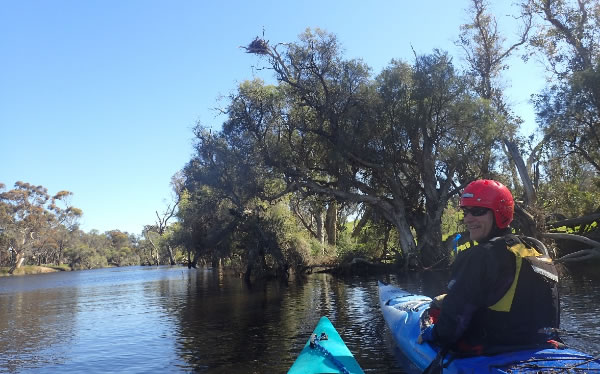
We disturbed herds of kangaroos and numerous water-birds, but perhaps fortunately not the occupant of the large nest high above the river (and probably higher up the food chain than a weary paddler).
An Eagles Nest and longer pool.
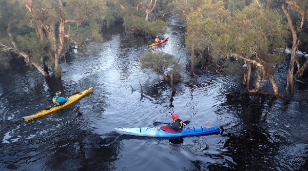
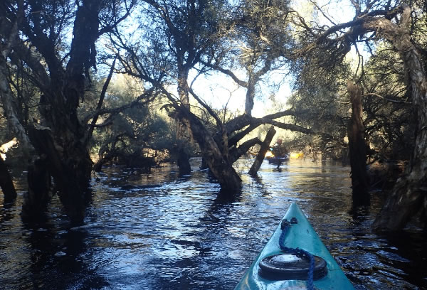
By Day 3 the river was beginning to open into longer pools, protected at each end by thickets of tea-trees and paperbarks.
Winding through the trees
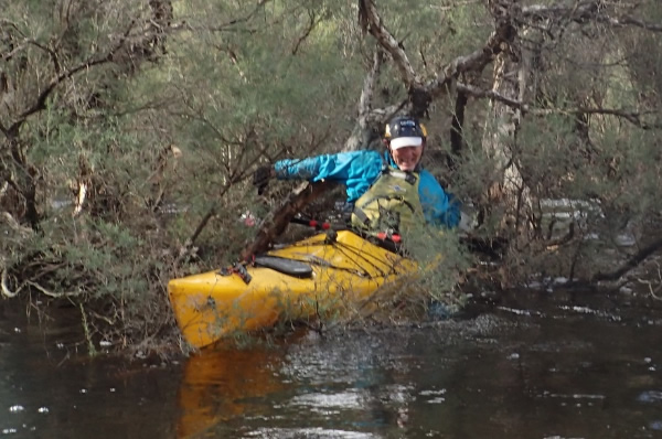
As the current quickened, so too the decision-making on which path to choose through the trees.
You be the judge
Sometimes the right choice was not especially clear. However we covered nearly 40kms, and camped overnight a few kms upstream from Albany Highway beside the picturesque Carberdine Pool. A support crew drive into the Arthur River townsite for a large serve of hot
chips dashed the illusion of rugged wilderness camping surrounded only by nature and the stars.
During the fourth day on the river we again managed nearly 40kms, paddling under both the Albany Highway and later the Coalfields Highway connecting Collie and Arthur River townsite. As the current steadily picked up speed, the obstacles became more hazardous – fences at
neck height, strainers at choke points, fallen logs... There were no mishaps in our paddling team on Day 4, however this is probably not a leg to be recommended for the casual weekend paddler.
Which way now?
Everything changed on Day 5. With faster water, tighter thickets and nasty surprises around every corner, team leader Richard M came a cropper and suffered an injury not compatible with further paddling. This would test the new safety protocol: three cold and wet
paddlers, one injured, with a hyperthermia-inducing wind whistling through the trees; Alan in support 6km downstream wondering where everyone was. Fortunately, the planning and preparation paid off. With a GPS and maps on board, plus a bit of ready-reckoning, we knew an occupied farmhouse was within easy walking distance. With a little luck we arrived at morning tea, and – without a moment of hesitation – the farm owner drove a rescuer to Alan at the waypoint, who could then
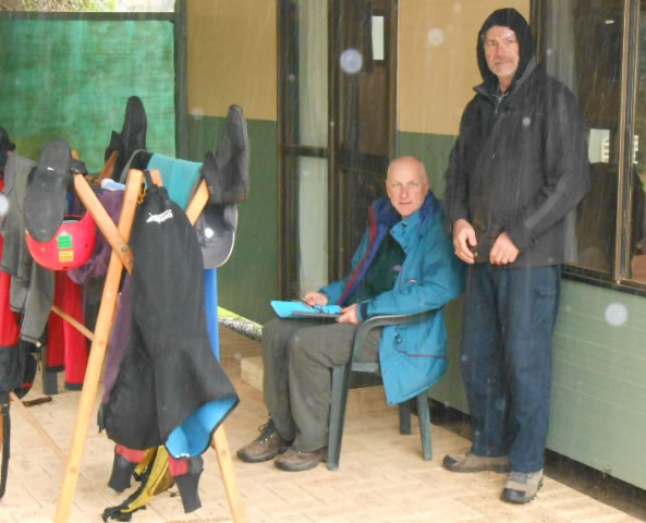
return to the river and collect Richard M. With 17km on the water, it seemed a good idea to finish early and take stock at a revised ‘camp’ in the Kojonup Caravan Park.
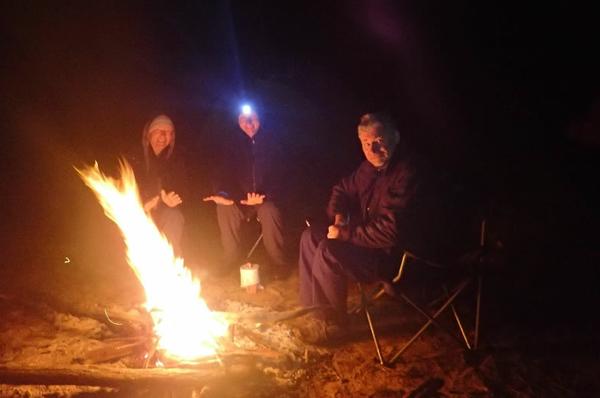
Where paddlers camp when it’s fine
Where paddlers camp when it’s cold
Where paddlers ‘camp’ when it’s raining
After a good night’s rest and recovery, Richard M’s injury was not as debilitating as originally thought, and the trip was back on! Richard M in support with everyone on the river needing to cover the final 50 kms over two days. As the river meandered south, then
west, the pools became long enough to be named, and our average speed picked up to a point where success was guaranteed!
Approaching a decaying bridge over the lower reaches
Long pools, fast paddling
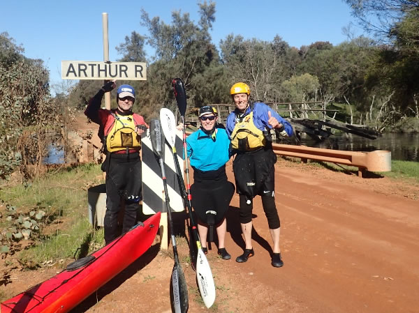
It was only in the final few kms where signs of human habitation became apparent: the occasional holiday home; small boats moored on the bank; rope swings into the river. Our final challenge was locating the take-out point – a flooded ford across Kulikup Road a few kms
downstream from the Arthur’s entry into the Blackwood. The river crossed at an angle, and neither the bank nor the road was discernible through a maze of trees and bushes. We could easily have sailed straight on past, however the GPS did not lie, and after a little traversing and meandering we emerged jubilant into the bank to celebrate the end of another Western Australian river paddle trip!
How paddlers celebrate success!
Trip Log
|
Day
|
Start
|
Distance
|
Avg Speed
|
Duration (hrs)
|
|
1
|
Yilliminning River (7km south of Yilliminning Road)
|
11.0
|
3.6
|
3:06
|
|
2
|
Rushy Point Road
|
28.3
|
4.3
|
6:32
|
|
3
|
Great Southern Highway
|
37.5
|
5.2
|
7:16
|
|
4
|
Carberdine Pool
|
38.9
|
5.2
|
7:25
|
|
5
|
Bokal Road
|
17.2
|
3.1
|
5:34
|
|
6
|
Rutherford Road
|
21.8
|
5.2
|
4:11
|
|
7
|
Moodiarrup Road
|
22.9
|
5.1
|
4:31
|
Team: Richard Swindale, Alan Morbey, Steve Coffee and Richard Molek.
I paddled the lower section of the Arthur and the entire Blackwood River some years ago so I remember some of those trees in the photos.
If you want to read about my Blackwood River Expedition go here:
https://terrybolland.wordpress.com/blackwood-descent/
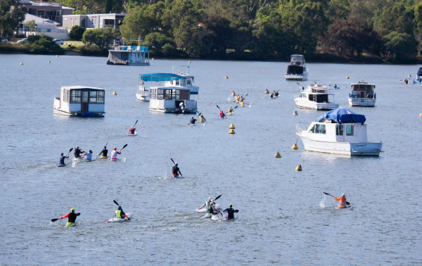
Canning River Race
Results here:
https://www.webscorer.com/race?raceid=169214
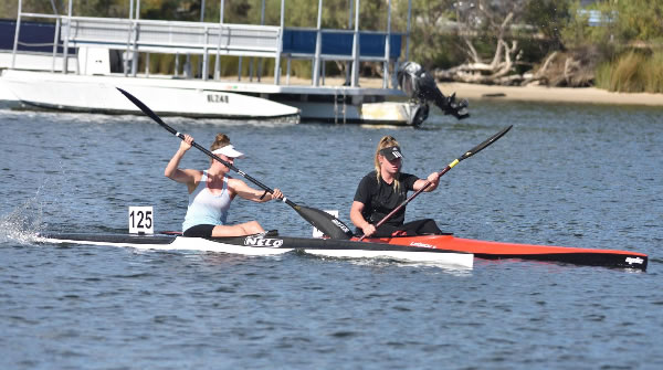
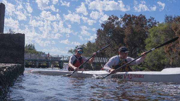
Me & Nathan, Dave & Maya and Mark & Nikki for the first 5kms then we got dropped. Photo Harriette Alexis
The single craft heading into Bull Creek Cove towards the turn buoy.
Photo Harriette Alexis
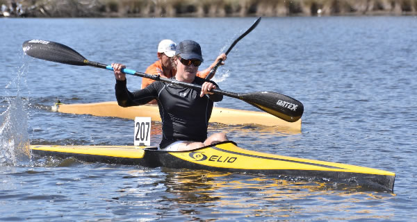
Angelina Good-Gerne & Shania Smee. Photo Lawrence Greed
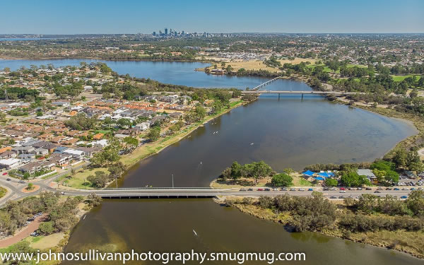
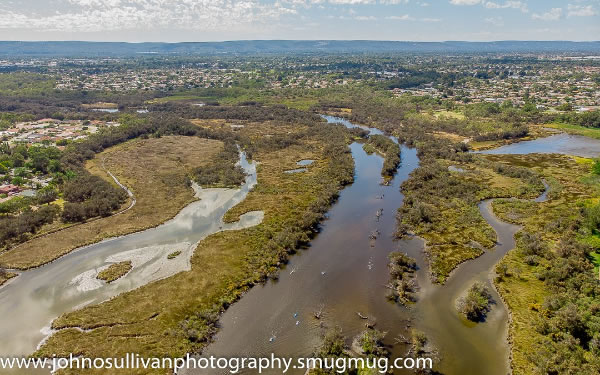
Riverton & Shelley Bridges and the city. Photo John O'Sullivan
Christopher Greed and Spencer King. Photo Lawrence Greed.
Christopher left for Penrith Wednesday to take part in the Wild Water Selection Race and some play boating.
Riverton Swamp Area. Photo John O'Sullivan
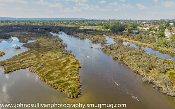
The turn at Kent Street Weir. Photo Harriette Alexis
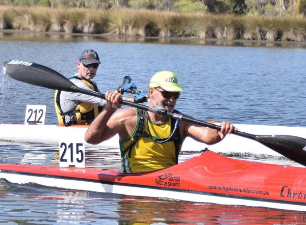
Matt Jones and Peter Liddle. Matt doesn't look too concerned about racing to the finish line. Photo Lawrence Greed.
Paddlers heading back. Photo John O'Sullivan.
Jane Liddle. Photo Lawrence Greed.
Results here:
https://www.webscorer.com/race?raceid=169214
Next Sprint Regatta
Sunday 24th February at Champion Lakes
And is the final regatta before the Canoe Sprint National Championships (6-10 March). If you are planning to race at nationals, come along for one last race on the course and perfect your race
strategies!
Rod Fry Memorial Race
On Sunday 17 February 2019 at 7:00am
Rod Fry is just around the corner and we are keen to make it even better than last year! Last year was a success with an earlier start as we avoided the bulk of boat traffic so we will be running everything on a similar schedule to last year.
Registration 7:00
Race Start 7:30
Location
Swan Canoe Club
16 Johnson Parade, Mosman Park, WA 6012
https://www.trybooking.com/book/sessions?eid=462611
Canoe Sprint Nationals Champs - Champion Lakes
Wed 6th to Sunday 10th March.
Important info...Some details are coming through from Paddle Australia to us in WA. Entries have been open one week and can be found here:
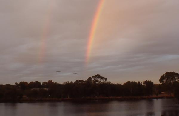
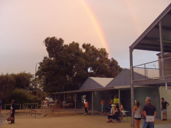
On Wednesday night at Ascot Kayak Club a Rainbow Crossed the Sky
The rainbow was much brighter in real life and shone in a big semi circle.
|
|
|
|
|
|
|
|
|
|