|
|
|
|
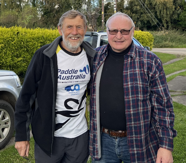
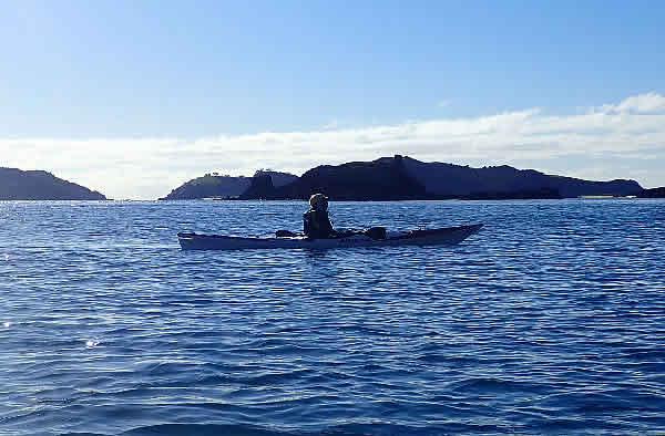
This week I have been doing more SUP paddling than kayak paddling to try to develop a good base for future events. Since last Friday, the beginning of the month I have paddled over 121 kms on the SUP plus 25 kms in a kayak. This morning I did a 5km time trial on my SUP and paddled it in 35.31, which was 35 seconds better than my best time so I was pretty happy with that time. Now I have to get below 35 minutes. A SUP takes a lot more out of you than a kayak. It gets your legs, your arms, your back, your neck, your core and
certainly your balance. It can be hard to paddle especially in a strong wind, but if you want to get an all-round fitness it’s a good challenge to take on. Sunday is the WA Mixed Kayak Championships at Moore River. I’m paddling with Jill Roberts who is half my age, but we have had a practise run on Wednesday night against Darryl Long & John
Hilton, and Chris Watson & Judy Darbyshire and we kept close even if it was on their wash so I'm looking forward to that race. Starting with the Mandurah Cut Ocean Race next week 16th November and finishing with the Doctor Race on the 30th November there are several ocean races in between, a bonus for the ocean
paddler.
- Watch Out World
- Travel Snippet
- SUP Paddling
- Ascot Kayak Club Juniors
- Jamila Gibbons
- The Yukon River Descent
- Paddling in New
Zealand
- Coming Events
- My Bird Book - Christmas is Coming
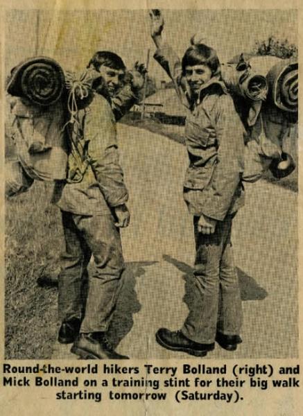
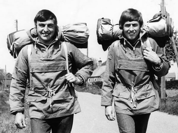
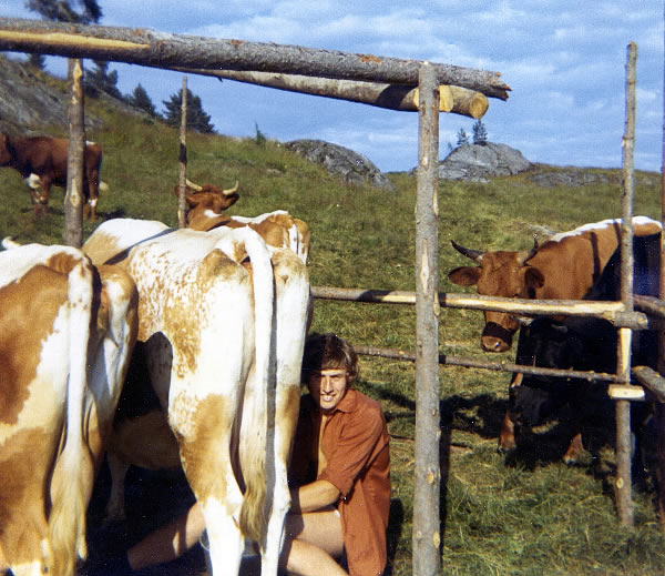
I left England to hitch-hike around the world at 19. Mick decided to return after working and hitch hiking around Europe for 5 months so we returned to England for a few months before travelling
again.
Mick and I now. Mick didn't get to Australia.
Working in Norway 1971- milking the cows.
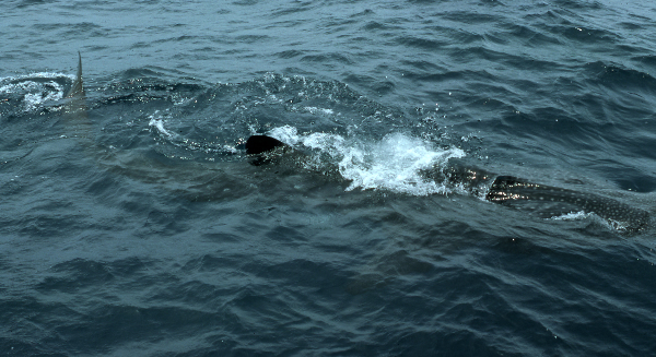
Travel Snippet Sun 21st December 1975 We were on a yacht off the Queensland coast on a 11 day diving trip. We were up early for a dive on an outer reef where we dived to 35 feet, and saw 7 sharks, 3 of them circling us. We also saw 3 big wrasse. We came to the surface with smiles on our faces. It was time to move on and as we were getting ready to move the yacht this huge whale shark swam by.
There was suddenly more excitement and Alan said he was going for a swim with it and within seconds all 7of us, except the skipper had our fins on and were jumping into the ocean. I didn’t know much about whale sharks back then as I don't think they were popular in Exmouth in 1975 or if there was any education about swimming with them. It swam slow enough for us to keep up and
although I was probably the last one to get to it I soon got up close. Its tail fin swept from side to side creating an incredible amount of bubbles. Being a little close it nearly hit my nose when it swept its tail across towards me. It was an amazing sight. We were there right amongst the action hardly believing that we were actually swimming beside such a massive whale shark. We looked on as our little legs tried to keep up with such an easy force of the flap of its tail fin. Eventually
it swam too fast so we returned to the yacht and caught up with it a few minutes later for another swim with it and it was just as exciting.
A Whale Shark just happened to come by.
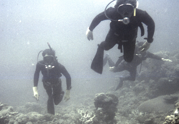
With the whale shark behind us we motored within six miles of Hope Island when we were hit by a storm, so we anchored behind Cairns Reef. When the storm passed we moved on to Hope Island and decided to go for a night dive. With darkness all around us and torches in hand, 4 of us fell off the side of the boat and into the water. As we descended we
could see no further than where our torches shone, and that wasn't very far. Beyond that light we had no idea what was out there. As we headed down to 35 feet, 3 sharks started circling us. Four torches suddenly beamed onto these sharks and we watched on in awe as they circled us at a fairly fast pace. Although it was our 3rd night dive we have had, we had seen a shark or two on other dives, but watching these 3 sharks circling us had us spellbound and what an another amazing
experience it was. I felt no fear, just excitement. Our torches also focused on stone fish, crays, small shrimps and lots of sea urchins. Fifty minutes later as we ascended slowly, the sharks were lost from our sight. What a day.
I went through a diving course in Port Hedland in 1974-5.
The AKC Pairs Enduro Race is on the 8th December 2024 so start looking for a singles partner to race as a pair. The idea is to start
together and finish together. You can wash ride each other to assist in more speed, but you can't wash ride other teams.
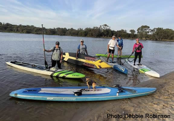
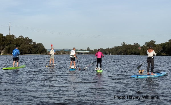
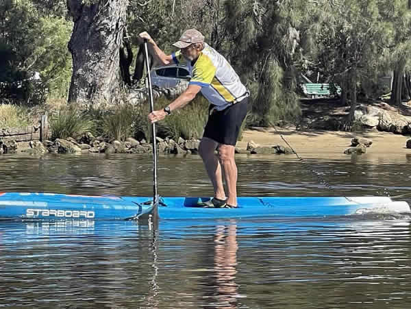
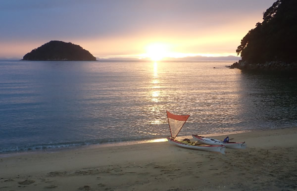
Friday night is SUP night at Ascot.
It was great to paddle back with the wind.
Last Sunday WA SUP put on a Paddle Loops regatta. A 4 km course or a 2 km course. A great event for beginners and the more experienced. Pick your time and win.
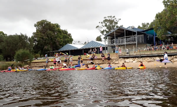
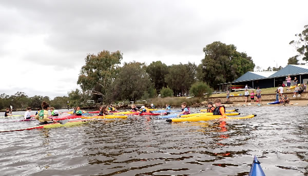
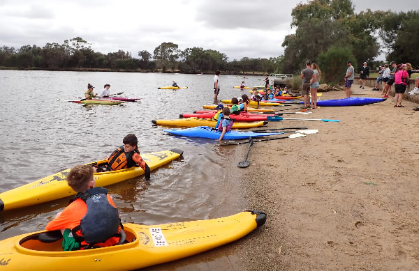
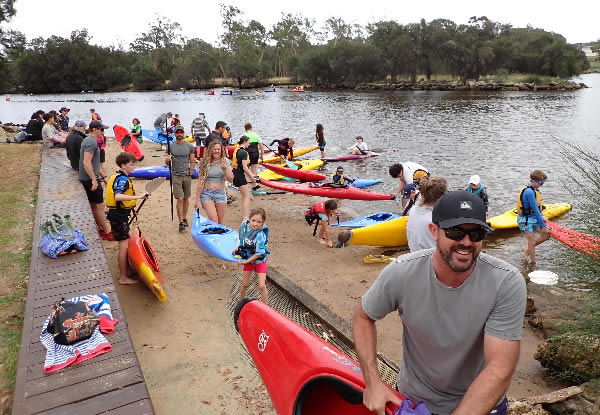
Ascot Kayak Club on a Saturday Morning
These 20 new juniors are part of Saturday morning fun.
With club instructors like Clare Pankhurst and Scarlett Florisson they make sure the kids really enjoy themselves.
Have you got a child who would benefit from these Saturday morning sessions?
Ascot are always looking for instructors and helpers for the junior programs. Can you help?
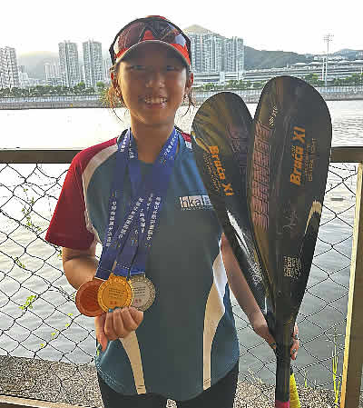
Jamila came to Perth in August to do some training and get some coaching from Coran Longwood. I taught her dad who used to live in WA. His parents still live
here. She really enjoyed the week of training and returned home to Hong Kong and won several medals. She is a happy girl.
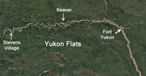
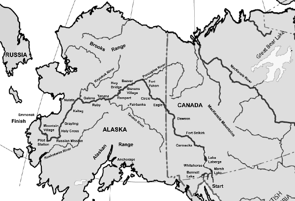
The Yukon River Descent We pushed off from the Fort Yukon groyne, passed a bunch of fuel tanks that had ‘Out of Operation’ painted on them and moved along the shore away from the main
village. It wasn’t long before we soon found out why there were no boats close to the village where we had stopped, they were all anchored a couple of kilometres further along the shore. There were about twenty of them, including the car carrier we had seen the previous day. A tent was erected under a tree, a few people were tending their boats and there was a couple readying their boat to move off. Our whole journey so far had been moving in a north-westerly direction, now the river direction changed and we were headed south-west following a current that spanned several hundred metres in width. The Porcupine River entered the Yukon to the north of us and according to the map it was an important winding waterway that headed further into the Arctic Circle and up into the mountains. Another River to explore, I thought. There were so many places to go and not enough
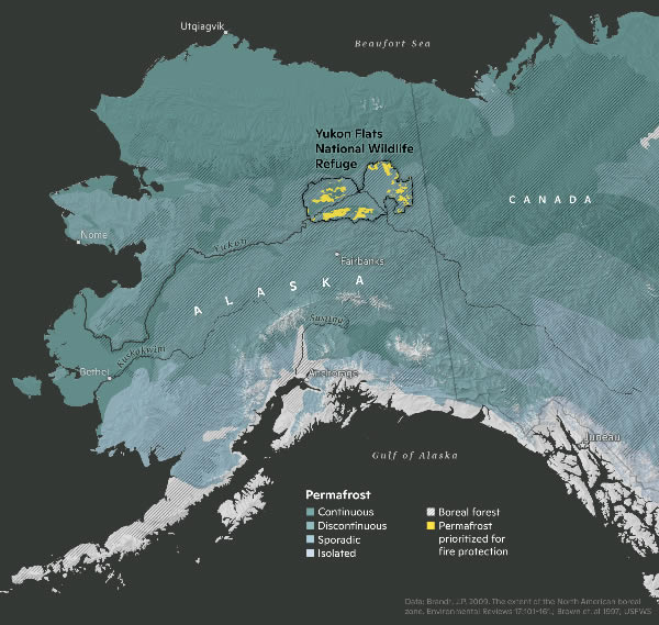
time in life to see them all. Also to the north of us was the Arctic National Wildlife Refuge, an important wilderness frontier for wildlife such as herds of Porcupine caribou which gather in their thousands. When the caribou move from the mountains to the wildlife refuge the massive herd have to attempt a dangerous crossing of the Porcupine River. The Refuge is in high demand as oil companies and governments want to go in and harvest the oil, but the local indigenous people and other
conservationists are trying to stop the move. The area to the west of it is already flooded with oil exploration companies, refineries and huge machinery, which has driven away much of the wildlife in that area.
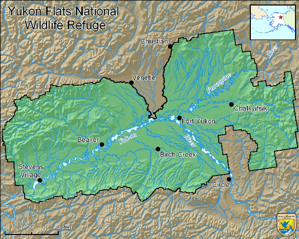
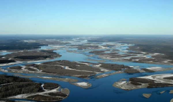
We head into the Yukon River Flats with it's maze of channels. The area in yellow.
Just as we thought the day couldn’t get any better, the sun came out and our last wish came true. Having been under a cloud of smoke haze for four days, it’s hard to imagine how good it felt to see the sun again. Without the sun it had been like living in a futuristic time where the sun played no part in living. But now the haze had gone and we
could feel the warmth, see the blue sky and all the beautiful scenery with clarity. Life was good. After three power boats had zipped by I thought the day was going to be busy, but they were the last ones we saw. Ahead of us were more islands and more channels to negotiate. Taking the correct channel was always beneficial for body and soul. To paddle further than we needed was very
disheartening. To achieve 80kms a day was hard enough but to lose the current and paddle further than we needed to, was disastrous.
If we took the wrong channel it could add kms to our journey.
We tried to follow the main route but we were dragged down another channel shooting off at right angles. The current was swift, it must go somewhere, but we didn’t really want to find out where as it looked as if it detoured the long way round. We fought hard to prevent ourselves from being washed along the channel, and with increased effort we
just managed to get across to where a fallen tree created an eddy. This gave us some respite before we powered against the current back into the main channel. I was quite surprised with the Yukon Flats. I had imagined the countryside would lack tall vegetation and be swampy, but in fact most of the islands had a large number of trees which grew so high that the land didn’t look low at
all. Most of the islands were about three metres above the highest water level. I also expected the flats to be teeming with bird life, but all we had seen were three dozen ducks at the most. There were more terns and gulls around than waterfowl. We hadn’t seen any animals except for one or two beavers and a few moose since leaving Dawson. My expectations of seeing a bear and lots of moose in the Yukon Flats had been shattered. Perhaps they were drinking from water holes away from the
river. Luckily for us the flats had islands that in turn had sandbars at the end of them where we could camp. Ed didn’t like camping near any vegetation where the mozzies were prolific, so we always picked islands with sandbars to sleep on. Although we camped on some great sandbars some of them were covered with stone pebbles, others were just mud and, due to the water receding every
day, the edges were often water logged and muddy.
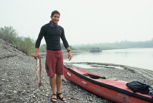
Ed always happy when he has a fish in his hands.
As we moved further into the Yukon flats, the channels widened and the current slowed. When those channels split into several more channels the current became even slower. We paddled around hundreds of wide sweeping bends that varied from 100 metres to 600 metres in length. The water was slower on the inside of the bends and faster on the outside
of the bends, but because of their huge size it was difficult to estimate whether we should paddle further and try to catch the outside current or paddle shorter distance on the inside with the slower current. We mainly stuck to the middle road! Pine trees dominated the islands. With no hills behind them, I noticed the different heights of the trees more than ever. There were always
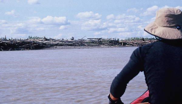
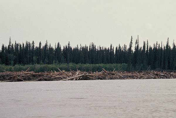
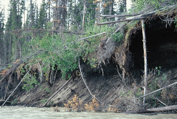
certain trees that stood higher than the rest. With the sun shining and the smoke haze gone, it was easy to pick up the finer details. The eroded banks, the fallen trees and a huge build-up of floating trees on sand bars were all the result of this year’s high water, and it had proved quite devastating.
I thought we would see thousands of birds in the National Wildlife Refuge but we saw very few.
A build up of logs on a sand bar.
Erosion caused by high water levels.
Our 1-25000 maps lacked the detail that we needed to work out exactly where we were amongst all the islands. Occasionally, though, one island was big enough to be recognised, otherwise they all looked the same, – just islands of trees will little elevation. As we moved from one channel into another, then into another, we were often left wondering
where the hell we were. The maps, again, on this occasion, were of minimal help. By late afternoon we were in a slow moving current trying desperately to push on to find a swifter one, still wondering where we were. As we paddled down a long straight, all of the country to the right was smouldering and blackened by recent fires. Pine trees were stripped of their greenery and were like
blackened matchsticks. We came across a beach, – well I should say a mud beach, – on the opposite side of the channel and decided to camp. Although it stretched for a few hundred metres, it only had a small dry patch for us to pitch our tents on the highest part, but we had to slop through 80 metres of mud to get to it. As soon as out tents were erected we dragged the canoe across the mud so we could have easy access to all our gear and food. It was 10.00pm when we landed, a little later than I had thought, due to it being daylight for-ever, but we were happy little chappies because we could see two other channels up ahead with swifter currents joining ours. Hopefully tomorrow we would have a speedier passage.
Monday 5TH July. We were eager to get away early so we could reach the village of Beaver before nightfall. To our delight the current did liven, but with so many turns en-route our speed was still slower than
we had hoped. To make matters worse, the wind increased throughout the day, chopping up the water and making our passage slower and wetter. We stopped briefly on a sandbar to check out some tents that were 600 metres away in a large bay. I thought it might be a 4th of July holiday camp, but somehow the tents looked more permanent. We looked through the binoculars, checking for any
movement on shore but saw nothing. A little further, as the river narrowed, we stopped for lunch on a stony sand bar away from the shelter of the trees in order to keep away from the mosquitoes. There was a strong, chilly wind blowing and we shivered as we ate our lunch. We
fished out the jar of pickled salmon that we had been given at Fort Yukon, and they were simply delicious. Ed loved them so much I had to remind him that I liked the delicacies as well!! Once Ed starts eating he just keeps going. He’s a growing lad but we had to be careful with our food stocks and to make sure we didn’t eat it all before the end. We also ate some tasty baby carrots that we had bought in Dawson 23 days previously; amazingly they had lasted that long. After slurping down a
bowl of noodles we ate the last part of the beautiful cranberry loaf. What a mixed up lunch, and one that we might never have again in our entire life.
The Yukon Flats is a maze of several channels.
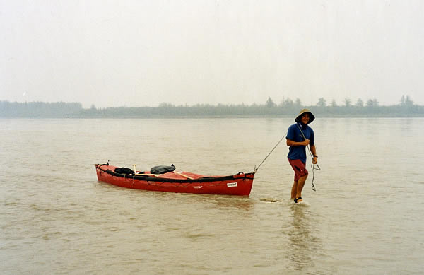
By the time we paddled the last straight into Beaver, it was blowing a gale. The chop and wind speed was pretty overwhelming. We could see some big new buildings on the shore but frustratingly a whopping big island in front of the village made it impossible to get to. Our map gave no indication that the island was there so it took us by surprise. A
channel that we had passed earlier apparently led to the community, so we had paddled further than we needed. A bay directly in front of the village looked promising to cut through so we paddled into it, but it soon shallowed, leaving us to wallow then retreat back to the main river to find deeper water. We continued moving further away from the village, but we eventually found a channel that led back towards it. With a kilometre to paddle in extremely windy conditions, our balance was truly
tested as large waves chased our tail.
As we headed towards the big buildings we could see a yellow canoe and two people under a pergola on shore. The wind soon pushed us beyond them, but luckily we reached our landing point without being swamped by the lumpy water conditions. Just ahead of us was the channel entrance, which we would have taken had we known it was the channel into
Beaver! Unfortunately we were too late to check out the tiny food shop, but at least the ‘Washteria’ was open and it had a phone. I tried ringing Jenny but the line was busy for at least forty minutes so I gave up in the end. I then rang the shop and Guy answered the phone and he informed me that Alaine was having the morning off to do some shopping. How slack was that! Beaver was 100 kilometres south west of Fort Yukon. It had about ninety residents living in the community, with 95 per cent of the population being Native, predominantly mixed Athabascan Indian and Yup’ik Eskimo. Almost all Beaver residents are involved in subsistence activities: they hunt or catch moose, salmon, freshwater fish, bear and waterfowl to live off. Most of the employment, as with many
villages along the river, comes from the school, post office, clinic and village council. Seasonal work comes from fire fighting and construction jobs. Whenever we asked people along the way what they did, most said they were involved in fire fighting, and what a year it was for fires.
Too shallow and too windy for Ed to paddle the canoe to the campsite by himself.
A notice board near the Washteria (laundry) revealed the history and wildlife around Beaver. Apparently gold discoveries in the Chandalar region, north of the village, led to its founding in 1907 as miners fled down the river to Beaver to start their journey overland to the mines. The Japanese connection was established in 1911 about the time the
gold rush was over, when Frank Yasuda, a trader and prospector, arrived with a group of Eskimos from Point Barrow and became a partner in the trading post. The store served the remaining mines in the region, supplied riverboats with firewood and traded with Eskimo and Indian fur traders. We asked a local where we could camp and were told of a site 700 metres west. Ed decided to paddle
the canoe there whilst I was on the phone. When I had finished I went to check to see if he had left. A man nearby said Ed was pulling the canoe along the shore because he couldn’t paddle it against the wind. He also told me that he was waiting for Rio, the Japanese canoeist who we had passed near Circle. Rio had stayed with him on four previous occasions. I walked along the gravel
track, passing small houses and sheds that were used to smoke fish. There were several forty four gallon drums scattered along the track that were used as rubbish bins. Everything was placed in the bins; paper, cans and plastics. When they were full they were fired. A few were burning when I passed and the smell and smoke from the plastics was awful and exceptionally unhealthy.
Kayak touring in New Zealand Linda & Royd Bussell New Zealand offers a wide range of scenic options for paddle touring. There are numerous lakes through the South Island and central North Island, many rivers are navigable in sea or touring kayaks, there are large inlets and harbours offering protected waters plus a range of coastal conditions for more experienced sea kayakers. We spent four years based in Wellington and paddled many areas throughout both the North and South
Islands.
Main centres: Auckland, Wellington, Christchurch and Dunedin are built around harbours providing paddling opportunities for city dwellers. Wind and shipping are usually the main safety factors to
consider. At our base in windy Wellington, the harbour has a scenic, rocky coastline and two islands, one of which (Matiu/Somes) is a protected nature reserve. Various seabirds, including little blue penguins, and NZ fur seals are commonly seen; whilst dolphins, porpoise and orca are less common. The southern coastline can be paddled in fair weather, westward to Sinclair Head,
beyond which tidal currents are strong. Paddling out of Mana or Titahi Bay, on the northwest coast, provides access to Mana Island, another nature reserve. More adventurous kayakers can paddle across to and around Kapiti Island, but are not permitted to land without a permit. Landing is possible at a small privately owned Fisherman’s Island off the southeast of Kapiti. A
Wellington based informal sea kayak network holds trips and training, organised via facebook. Kayaks can be hired at the Wellington waterfront.
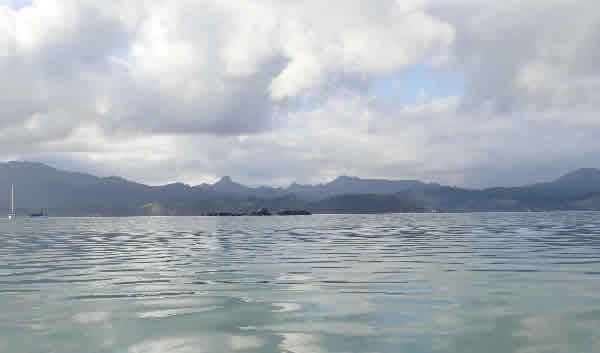
Urupukapuka Islands, Bay of Islands.
Inlets: Tidal flows and water depth are factors to consider for most NZ inlets. In the North Island, large inlets are found at Hokianga Harbour, Wairoa River, Manakau and Waitemata Harbours (Auckland), Whangapoua
and Whitianga (Coromandel), and Matakana Island (Tauranga). In the South Island, the main accessible inlets include the Marlborough Sounds, Whanganui Inlet (Northwest Nelson), Christchurch inlet plus Lyttleton Harbour, Akaroa Harbour, Port Chalmers (Dunedin), Awaroa Bay (Bluff), Milford and Doubtful Sounds, and Okarito Lagoon (West Coast). Commercial day paddle tours are available on many of these, notably the spectacular Milford and Doubtful Sounds and Okarito Lagoon. On Stewart Island,
Patterson Inlet is available to paddle out from Oban.
Paddling offshore from Coromandel.
Coastal Waters: There are many areas for spectacular, relatively protected sea kayaking around the NZ coastline. The Bay of Islands in northern North Island can be accessed from Paihia, Russell or other smaller
villages. Multi-day trips can be undertaken, with DOC campsites available on several islands, popular in summer. A day trip out of Russell or Rawhiti, allows access to most of the main areas of interest. Aucklander paddlers have access to several offshore islands, including Waiheke with its numerous gorgeous bays. The Coromandel Peninsula offers a variety of paddling opportunities. There is a commercial day trip to Cathedral Cove (access by land is currently closed to tourists) and islands nearby. We preferred paddling near Coromandel township on the western peninsula, where several offshore islands and bays can be explored. The remnant volcanic landscape and large, coastal pohutukawa trees combine with the bays to create impressive
scenery. In the South Island, the Abel Tasman National Park is a paddlers’ paradise. With golden sand beaches and native forest to the water’s edge it is a popular destination for tourists and locals alike. DOC campsites (with toilets and water) and huts are available throughout the park and must be booked in advance. Some camping sites are shared with camping hikers, whilst
others are normally paddlers only. The seas can be rough when the wind is from the east or north. The inlets are strongly tidal and best accessed around the high tide times. Watch out for stealing weka and those pesky sandflies. Multi-day expeditions are possible in the park, with several kayak hire and guide options available out of Marahau. Hire companies do not allow paddlers to go beyond Awaroa Inlet. However, some of the best areas of the park lie either side of Separation Point, where the
visitor numbers are less. Water taxis can transport kayaks and paddlers to various bays if a one-way paddle is preferred (note, they do not transport private fibreglass kayaks). The Araroa Lodge within the park has accommodation and a nice café. To be continued....................
Onetahuti morning, Abel Tasman NP.
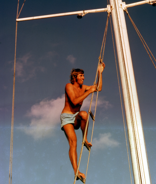
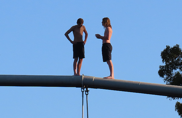
What do you think, should we jump.
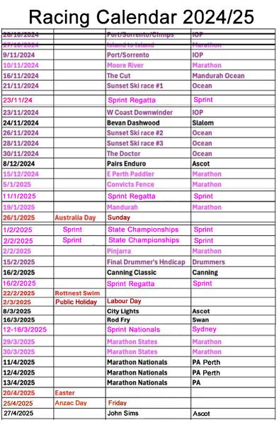
Moore River Race 10th November 2024 Mixed Doubles Championships
Singles welcome to race.
Mandurah Cut Run 16th November 2024 Sprint
Regatta 23rd November 2024 West Coast Downwinder 23rd
November 2024 Bevan Dashwood Race 24th November 2024 The Doctor 30th November 2024 8th December 2024 Pairs Enduro Get a singles partner and race as a pair
Mandurah Cut Race Saturday, November
11th! The 12.5km course, a fast downwind race starting from the Dawesville Cut, follows the coast north to Halls Head and finishes at Doddies Beach. The perfect warm up for both The Doctor and the ICF Canoe Ocean Racing World Championships held later this year! Registrations close Friday 10 November so get yours in quick!
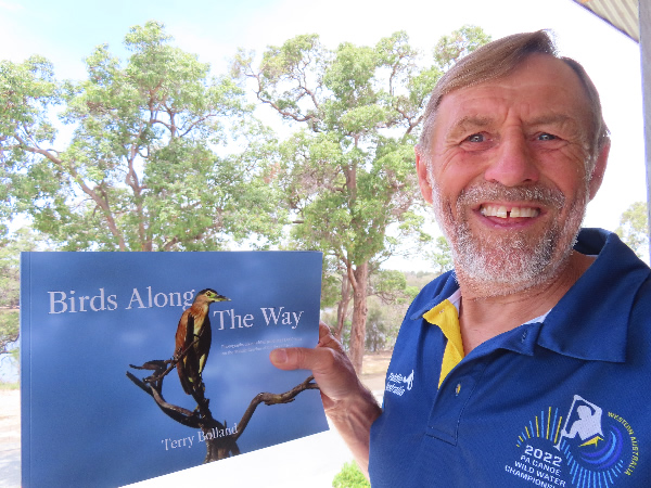
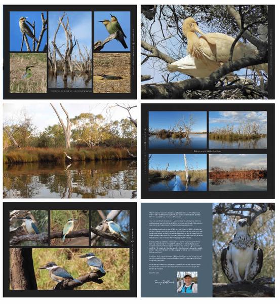
Christmas is Coming My Bird Book What a great present
|
|
|
|
|
|
|
|
|
|