|
|
|
|
My latest project is nearly complete.
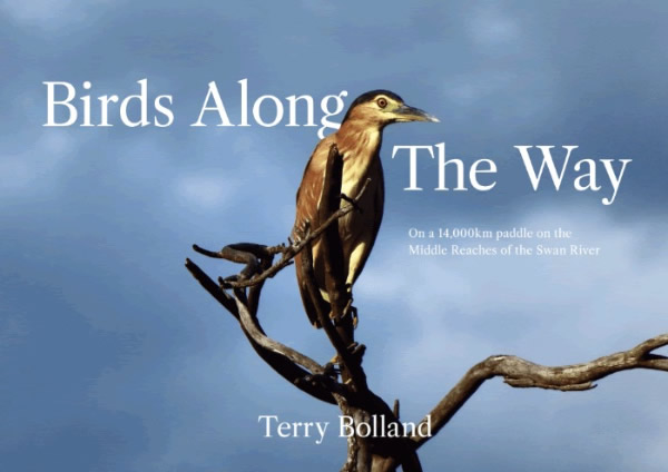
I’m referring to my all colour 150 page Bird Book.
There are 54 species of birds, 412 photos, which 285 of them are birds.
They are photographs that I took on my 14,000 km year-long paddle. If you are thinking of buying one, just send me an email and that will secure it and give me a better idea of
numbers. I’m hoping it will be out by early December. Send me a message to terry@canoeingdownunder.com.au
150 pages - 54 species of birds - 412 photos - 285 of them being birds.
- Who's Out There
- Scouts Canning Canoe Assent
Harry Hewitt at the World Marathon Champs - Mandurah Cut Run
- 33 Years to the Day
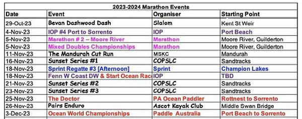
- Coming Events
- Sprint
Regatta - Sat 18th November
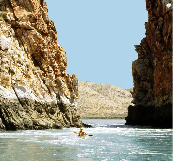
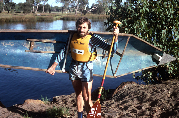
If you are thinking about paddling through the Horizontal Waterfalls (the Gaps) in the Kimberley, you better do it now as it might be closed for tourists soon. I paddled it in 1982.
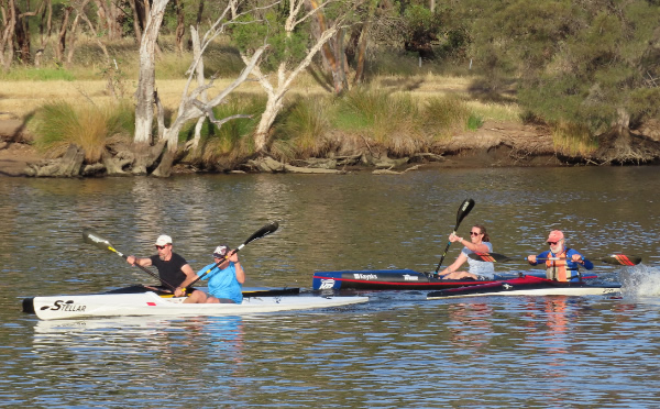
There was some good racing Tuesday evening at the Progressive Racing Group session. John Liso, Chad Sorenson, Kate Martin
and Peter Martin.
Peter Martin ended up being the fastest in that small group.
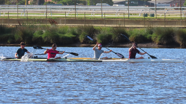
David Burdett, Coran Longwood, Stephan Weyers and Michael Gorie in training.
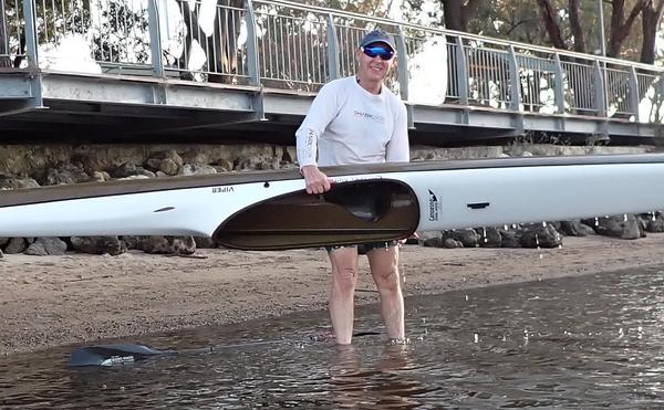
Geoff Mclean. Geoff has been paddling a long time, and although you don't see him in many races, he is still out there
paddling the kilometres.
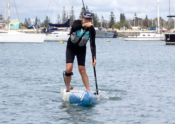
I have done a very stupid thing.
I have entered the Moore River 13 km Race on a SUP. I have found that there is much more strain on my body paddling a SUP
and it's much harder to push along than a kayak. And I haven't stood up on one for more than 5 kms, so
13kms is going to be a killer. Do I assume that the further I paddle, the easier it gets. Or will I be lucky to finish without taking a long rest a long
the way. May-be someone could bring a tow line just in case. LAST CHANCE TO REGISTER MOORE RIVER: And Mixed Doubles Champs on Sunday [5th]
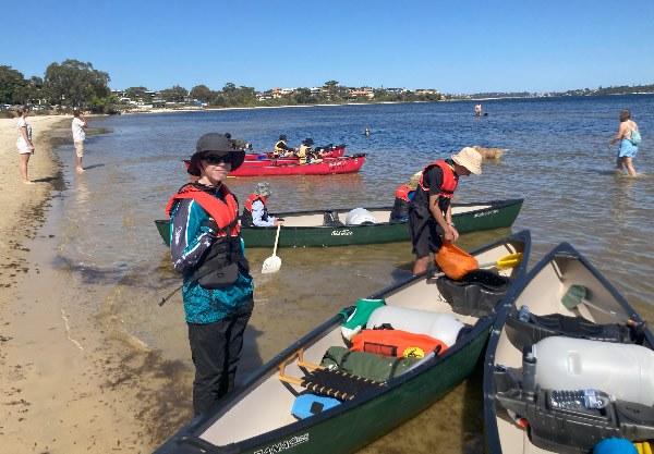
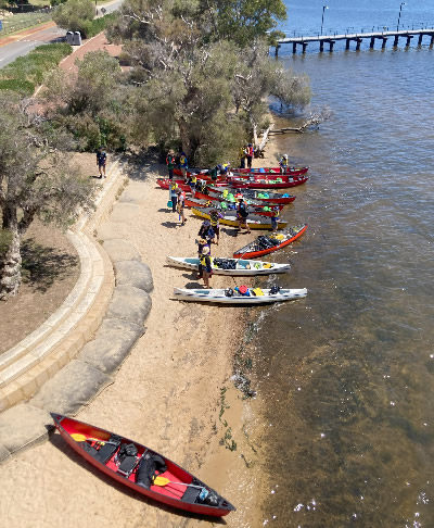
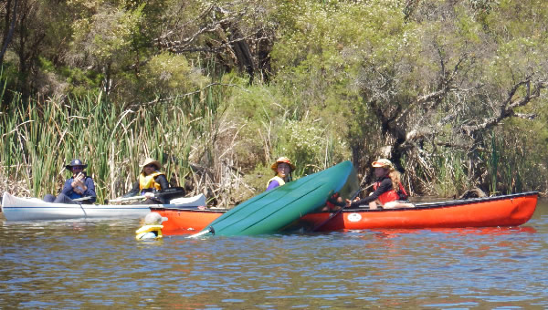
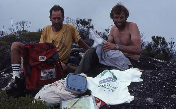
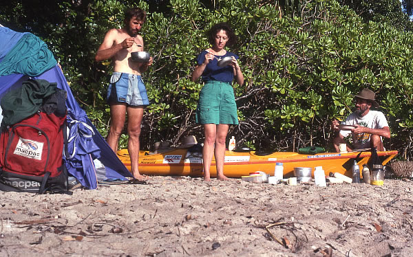
Canning Ascent 2023 Bronwyn Martin On Saturday the 15th of October, 56 Scouts accompanied by 26 adult leaders began a two-day canoe hike up the Canning River. We left the Waylen Bay Scout Hall and started the day with a hard paddle into a head wind until we got
around South of Perth Yacht Club then it was an easier paddle under Canning Bridge and past Deep Water Point. After lunch, at the Mount Henry Bridge Reserve and a significant boost to the local café, we continued upstream past the posts with a pause to look at the sunken barge that was visible from the canoes due to the low tide. Actually,
some of us nearly ran aground on it. During this section one canoe and one of the support power boats collected nearly a kilogram of fishing line off the posts.
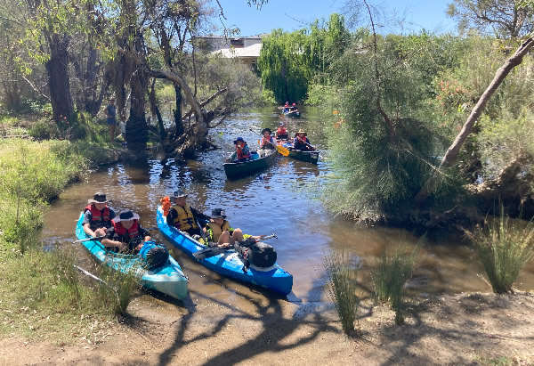
56 Scouts accompanied by 26 adult leaders began a two-day canoe hike
up the Canning River.
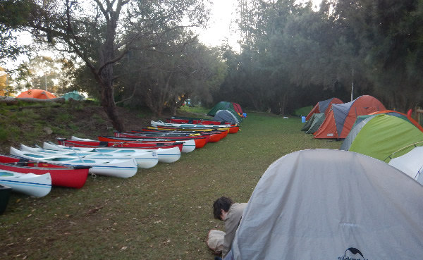
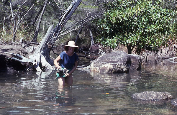
The final 200m to the Canning Sea Scout Hall was a very shallow with a delicate pass over the mud flat before a slippery operation to get all the canoes, and Scouts, out of the water and on to the grass next to the hall without covering ourselves in mud. Once all the tents were up some of the Scouts got straight in to making their dinner while others, who obviously didn’t paddle hard enough, explored. After dark, we watched a movie and then everyone went to bed early to be ready for the next day. Come Sunday
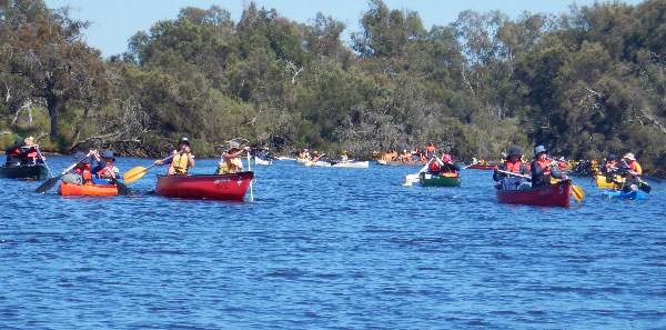
morning we were all up bright and early, some more early than others as the sprinklers came on and sprayed some of the leaders’ tents at 4:30 am. After eating breakfast and packing up all the tents we were back on the water and if we thought Saturday afternoon had been low tide Sunday morning was almost a metre lower. After several slips, one lost shoe and mud everywhere all the Scouts were back in their canoes and we headed up river towards Riverton Bridge. At Riverton Bridge we meet the Fury River Dragon boat. We saw them multiple times as their rests between efforts were just long enough for the lead canoes to catch them before they took off again. Several Scouts thought dragon boating looked easier than canoeing, they were particularly keen on the drummer’s job.
Out of the shallow water.
Some deep water rescue training.
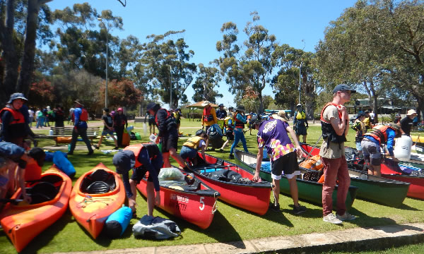
When all the Scouts had portaged their canoes around Kent St Weir, we emptied all the gear out of the boats and headed upstream so the Scouts could cool off while practicing some deep-water rescues. Good fun was had by all. After lunch and repacking the canoes we continued upstream. The front canoes got to admire all the paperbark blossom on the water and the birds on the banks. The following canoes saw only muddy water and empty trees. We arrived at our end point of Hester Park mid-afternoon; hot, tired
but satisfied with our efforts. After packing all the canoes on to the trailers and a quick debrief everyone headed home for a highly anticipated shower, apparently swimming in the river doesn’t count as a bath, and an early night.
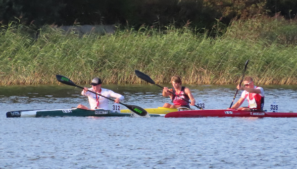
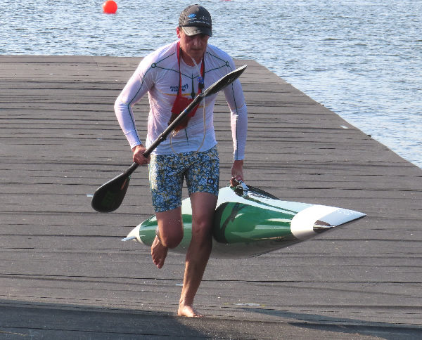
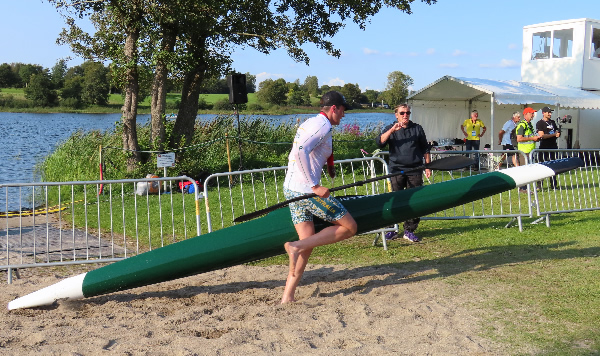
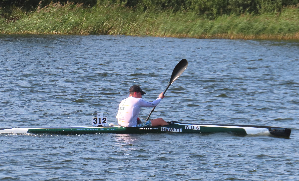
Harry Hewitt 2023 World Marathon
Championships Harry Hewitt paddled very well in his first World Marathon Champs. Although he couldn’t match it with the top paddlers he kept plugging in and had a race with two other paddlers and came 22nd out of 30.
He would have learnt so much from the
experience and it is good to see him and his family take on Marathon paddling. His dad, Ben also paddled in the 50-54 and came 12th out of 32.
Harry had a race with two other paddlers.
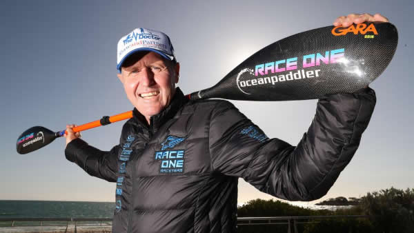
Well know Downwind paddle champion Dean Gardiner will be taking part in the
Cut Run Downwind Race.
Ocean Paddlers to Descend on Mandurah
for the Cut Run Australian paddle champion Dean Gardiner will be taking to the water for Mandurah’s annual ocean paddling event next month. The Mandurah Cut Run will see competitors set off from the Dawesville Cut groyne to Doddies Beach on November 11. The downwind race was previously known as the Mandurah Duel and has this year changed hands to be run by the Mandurah Ski and Kayak Club. The 12.5km event forms part of Perth-raised nine-time world champion Gardiner’s annual Australian Ocean Racing Series, which is run through his organisation
Oceanpaddler. The event is open to stand-up paddle boarders, outriggers and ski paddlers. Race times are staggered between crafts. Mandurah Ski and Kayak Club president and event organiser John Reynolds said the Cut Run would
challenge paddlers taking part but expected it to be “an incredible amount of good fun”. “It is challenging, because what you’ve got is generally, at that time of the day and that time of the year ... the winds, we hope, are south-southwest and would be blowing at around 30 km/h,” he said. “That would be really ideal, with a two to three-metre swell — and that’s not for the faint-hearted.” Despite the potentially challenging conditions, Mr Reynolds said paddlers of all experience levels could take part as an introduction to downwind paddling. About 150 competitors are expected to join in, with about 75 per cent from interstate and overseas. Mr Reynolds said their safety was the first priority.
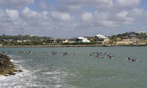
The easy bit. Most downwinders would say the boring bit.
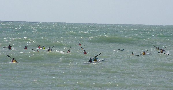
The sea starts to get interesting as paddlers enter the ocean. They are suppose to be heading to the
right!
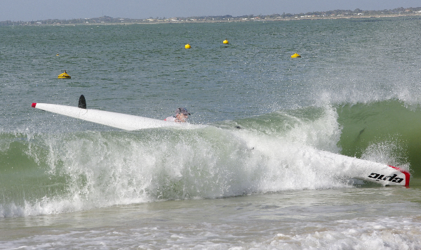
It's usually an easy landing. The Mandurah Cut Run Saturday, November 11, 2023 The 12.5km course is well known to paddlers, being a fast downwind race that starts at the Dawesville Cut, follows the coast north to Halls Head and finishes at Doddis
Beach in front of MSKC. 10:00 - 12:00 Registration 12:00
Safety briefing 13:48 First wave starts 14:00 Final wave starts To all our sponsors and in particular the City of Mandurah, we thank you for your support and encouragement - we couldn’t have this event without you. Go here to enrol: The
Mandurah Cut Run 2023 | Event registration | Webscorer
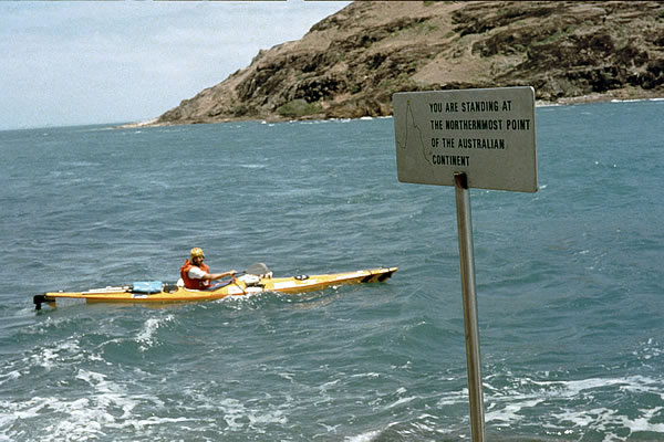
33 Years to the Day On a 24,000 km Paddle, Cycle and
Backpack/walk
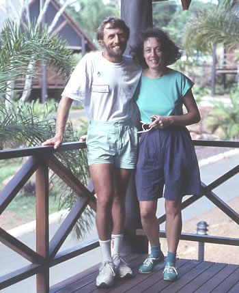
around Australia I had been kayaking, walking and cycling for nearly 7 months around the remote regions of Australia. I hadn't seen Jenny since leaving Perth in May, but for the last two weeks whilst I had been cycling south
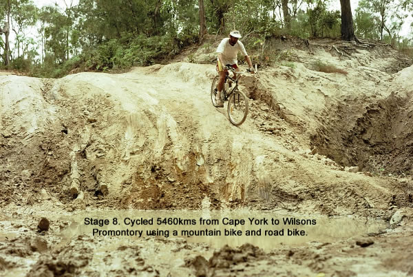
she has been part of my support crew with Tim. She has one more week to go before heading back to Perth. On this part of my 24,000 km journey I had just cycled from Cape York and now I'm about to paddle around Hinchinbrook Island and climb Mt Bowen.
Other legs done - included Paddling from
Augusta to Geraldton - Cycling from Geraldton to Wiluna - Walking from Wiluna to the Tanimi Track via the Canning Stock Route - Cycling the Tanimi Track to Alice Springs - Walk from near Alice across the Simpson Desert to Birdsville - Cycle from Birdsville to Cooktown _ Kayak from Cooktown to Cape York - and now I'm Cycling from Cape York to Wilson's Promontory as well as paddling a few special areas like Hinchinbrook Island.
After paddling from Cooktown to Cape York I took to my bike to cycle south.
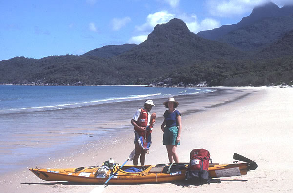
A reunion in Cairns with Jenny after spending nearly 7 months paddling, walking and cycling around Australia and not seeing her.
33 Years to the Day November 3rd 1990. Cardwell
Queenland. At the Cardwell jetty, I entered my kayak for my next leg across to Hinchinbrook Island, Australia’s largest National Park Island. I had talked to Fay from the National Parks office. She was very helpful with information about Hinchinbrook Island and a very pleasant person too, I liked her. It makes me wonder why all people can’t be as
friendly. Her off-sider in the office had been really official, quite abrupt and impossible to get any information out of. I was loaded and away by 9.00am waving to Tim and Jenny as I left. Soon after, the ferry carrying them across to the island passed me by. It created a good wake so I paddled on it and got a good ride for a time, until it headed in a northerly
direction. Looking over to my right, down the Hinchinbrook Channel I could see the seepy, brown-coloured water filtered between forests and forests of mangroves that lined the foreshore and choked the southern end of the channel. A strong tidal current ripped through the deep passage. I soon passed the mangrove headland of Hecate Point and entered Missionary Bay
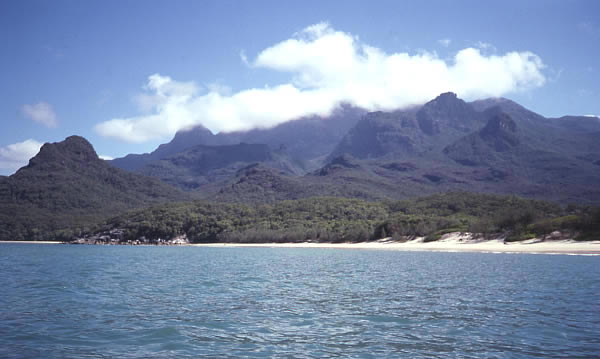
where I met an old fishing boat, ‘True Blu’. The skipper asked me if I needed anything, or a tow. I declined both offers, thanked him and headed against the wind and tide towards a huge bay, blocked for several kilometres by mangroves. My thirst was continual but the view was spectacular; mangroves in the foreground with Nina Peak and Mt Bowen plus other jagged mountains in the background. I could see a diverse array of trees and dense rainforest on the island.
Paddling along the island.
Several channels forged deep into the mangroves so it was difficult to make a decision which way to go. One wrong turn would have meant several extra kilometres paddled – something I didn’t want. Checking my map, and the instructions that I was given, I entered a mangrove creek. There was nothing to indicate that I was in the
correct channel and I became a little concerned, but further down the creek I noticed a marker and that reassured me.
The creek started to narrow and meander, and again I enjoyed stunning views of the super lush mangroves and the mountains. I was now a lot more confident that I was on the right track and gave little thought to the crocodiles that may habitat the area. A ferry that had passed me earlier came into view
from around a bend in the mangroves, trailing white waves from the bow. It closed in, forging forward until it passed. The skipper shouted, “Only two kilometres to go.” The channel narrowed perceptibly as it turned south, until it was barely wider than the boat that had just passed. With the low tide, the mangroves were now left growing in the mud. Their roots
poked through the mud like stubbed antlers. The creek was quiet, apart from the popping and clicks made by shrimps, crabs and mud skippers, and my wake lapping up the mud. Mangrove leaves littered the waterway, floating like tiny boats and pushed along by the breeze. Jenny and Tim cooeed and shattered my peace but I was happy to hear their greeting as my body was
tired. They were standing on a timber walkway, which was at least three metres higher than the water level and surrounded by thick mangroves. A ladder led down to the mud. I landed in the mud, dragged the bow to the ladder where as a collective team, we attempted to lift the kayak directly up the ladder, but it was too long and an impossible task. We paused to get our breath while Jenny passed me down a drink, which was warm, but it didn’t matter. I was longing for liquid. We were beaten by the ladder, so we reassessed the situation and decided on a route through the mangroves. It was quite steep and slippery, with mangrove roots making it difficult to step, let alone drag the kayak up. We struggled, yet managed to get the kayak to the walkway before resting again. The toil continued with a 250-metre-long walk along a walkway carrying the
kayak, followed by a battle up a high sand dune. The struggle was worth it. The beach on the seaward side was absolutely magnificent, with the white sands stretching for kilometres to the north and several hundred metres to the south. Beyond the southern beach, Nina Peak and the distant mountains created a backdrop that was world class.
On the seaward side of the island.
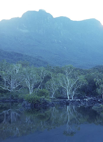
Looking towards Mt Bowen 1121 metres.
Sitting aloft the sand dune, we ate lunch and watched over the magnificent island. We talked about the beauty around us before Jenny and Tim departed, walking along the beach with packs strapped to their backs. Our aim was to meet up at a camping spot further south. They would walk; I would kayak. I moved on down the coast,
watching the clouds clear around the mountain range, but lightly hover around Mt Bowen. The peaks looked very rugged with deeply intersecting craggy slopes and I began to wonder what we had let ourselves in for, as Tim and I were going to climb Mt Bowen the following day. I arrived at Little Ramsay Bay at 4.30pm. Only one tent was erected in the trees. I dragged
my kayak up the beach and was surprised to see Peter Jess and his girl-friend under the bushes. I’d met Peter on his motor bike near Elliot Falls, Cape York. Soon after, Dennis, (another English tourist) arrived looking absolutely shattered. He had accidentally climbed Nina Peak carrying his full pack, mistaking it for the main track along the island. When he’d met two other English people on the top with day packs on, he couldn’t believe what he had done. An hour later, Jenny and Tim
arrived. We camped in the trees, had a swim in the ocean, being careful not to get tangled in stingers, and then had tea. Later that night we sat out on the beach, staring into the full moon. It was brilliant apart from being annoyed by mosquitos. November 4th 1990. Hinchinbrook Island. Tim and I were up at 6am, and packed a rucksack with food, 5 litres of water and emergency gear, which included a long rope, knife, and First Aid Kit. Our walk started at 7.00am taking us past the lagoon and along the creek bed,
rock hopping upwards across sloping rock slabs and large boulders. Birds were chattering away among the trees in our stream bed and far up into the mountain scrub. A list of birds given to us by the rangers named 150 different species that had been recorded on the island. Most were resident to the island, while several were migrants and some were occasional visitors. For the keen birdwatcher, the list invites people to register any birds that are not on the list.
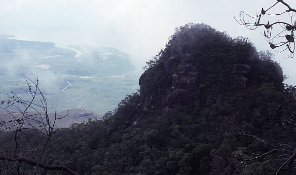
By 8.45am we were close to and below a vertical slab hill. We kept following the creek finally reaching a fork where we left the left hand narrow stream to follow a dry, wider creek bed to the right, at which point our route became steeper. At 10.00am we came to another fork. The left led up to a small waterfall but we followed the main waterless creek to the right. The climb became steeper and once the trees closed in, the climb became harder. We struggled on, reaching a saddle between two mountains at 11.00am. There we rested for 15 minutes in a small clearing with a towering rock close by. Heading south, we skirted several rocky outcrops before following the
ridge through burnt banksia. Our clothes, hands and face became black and the sweat ran down our faces, leaving grey streaks. By noon we reached a peak with several boulders that we incorrectly estimated to be the summit but it turned out to be a false summit. With the cloud surrounding us, visibility was down to the minimum but at times it cleared enough to get glimpses of the Hinchinbrook Channel and the mangroves. We moved on a little further and found the summit nearby where we had lunch
next to a cairn. The spectacular north face of Mt Bowen drops 1121 metres, featuring cliffs and then forested scree slopes which run almost to sea level. We rested for a while, took our shirts off to dry, found the plastic tube containing a visitor’s book, and signed our names. Just before our departure at 2.10pm, the clouds separated for a short while, this time giving us views of the east side of the mountain towards the ocean.
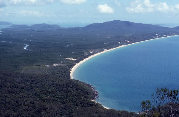
Looking down to the beautiful beach and the channel that I paddled up.
Tim and I on top of Mt Bowen.
Our return to the camp was swift. We were greeted by Jenny at 5.40pm. She’d had a pleasant day relaxing, swimming, keeping away from biting March flies, and had moved our tent to a place with a view of the ocean and one which would be cooler in the night. English Dennis had returned earlier from a walk that he’d attempted to
Zoe Bay. He hadn’t been able to find the track after a creek crossing so returned without seeing it. It wasn’t his day again. Tim and I looked a picture. We were blackened with charcoal, our clothes stunk with sweat and dirt and Tim’s face looked extremely haggard. Hell knows what I looked like. I had a swim to freshen up. After tea, the huge red moon lifted from
the water like an enormous hot air balloon on fire. Within moments the grey clouds on the horizon began to bleed, the redness absorbing the lower parts of the clouds and setting them ablaze. Jenny and I watched in amazement as darkness turned into fire and then faded into a dull light, as the full moon gained height. We both knew that we were witnessing nature at its best and we were at the pinnacle of our time together. We longed for the night to go on but the mosquitoes and sandflies prevented
the evening from being just ‘absolutely perfect.’
Jenny crossing a creek and heading back to catch the ferry whilst I paddled along the island and further south.
Have a look at the background. That is Ron Courtney Island with only big flooded gum trees on it.
You can just see the sign that says "Department of Justice' which now can't be seen because of so many Casuarina trees. The island was formed in 1969 after a channel was cut through Garvey Park in an effort to alleviate the erosion caused by the flow of the
Swan River.
Sprint Regatta #3
Sat 18 November 2023 -
Afternoon race. Assuming the Fremantle doctor makes its arrival on schedule, could be some quick racing! https://www.webscorer.com/register?raceid=333861&fbclid=IwAR05W7o5yUxZAG86itTh_MAYrXHEnOQBzFd9VgVr_dZZRmfOmkT706nHtzE
The 2023 ICF Canoe Ocean Racing World Championships
in Perth, WA Don't miss out on this incredible opportunity. Register for the 2023 ICF Canoe Ocean Racing World Championships by visiting the official event
website. Regardless of your skill level, this is your chance to be a part of something extraordinary. From November 30th to December 3rd.
|
|
|
|
|
|
|
|
|
|